Lower Niobrara River Valley Driving Tour - Miles 5 to 15

Niobrara River Valley 2
The Lower Niobrara River beneath an expansive sky

NPS


Mile 5.0 – Veer left as road turns to gravel

Spotlight on Geology
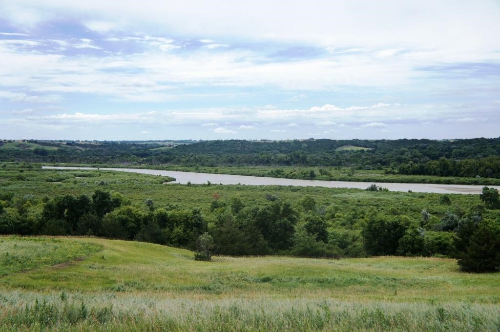
The Niobrara River is a groundwater-fed river draining the Nebraska Sand Hills. The river is an ideal example of a highly dynamic, unaltered, and braided, prairie channel providing habitat for many shorebirds, including the federally endangered interior least tern and the threatened piping plover. The Niobrara contains a wide variety of physical features, including floodplains, sandbars, islands, and chutes. Pierre shale outcrops, while not unique to the region, are interesting and visible in this reach. Landslides and loess deposits are generally absent in this river segment.

Mile 11.0
– Road changes to 517th Ave.
Mile 12.0 – Turn left onto 891st Ave.
Mile 14.0 - Turn left onto 892nd Ave.

 
National Park Biologist holding a channel catfish in the Niobrara River

NPS


Spotlight on Fish and Wildlife
Fishery: Natural flows, water temperatures, and sediment transport in the Niobrara River sustain an intact native fish community of 37 species within a dynamic braided channel. Unimpaired, natural river conditions are scarce throughout the region. Large river species such as the federally endangered pallid sturgeon, federally threatened shovelnose sturgeon, and blue suckers, have also been found in the lower Niobrara River. In addition, the natural tributary flows from the Niobrara River are essential in sustaining the natural production of paddlefish and saugers in the adjacent reach of the Missouri River.

Mile 15.0 – Go straight at stop sign

Click here to go to the Lower Niobrara River Valley Driving Tour - Miles 15 to 27

Last updated: April 10, 2015

Park footer

Contact Info

Mailing Address:

508 East 2nd Street
Yankton, SD 57078

Phone:

605-665-0209 x21

Contact Us