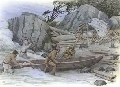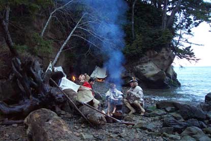
History of "Dismal Nitch" The Dismal Nitch area is located within the traditional territory of the lower Chinookan people. Through common usage, the term Chinook has come to refer to all speakers of the Chinook language family who inhabited the territory from the mouth of the Columbia River upstream to The Dalles and along the lower Willamette River to present-day Oregon City. Of the many Chinook villages along the north shore of the Columbia River, two known summer villages were located in the vicinity of the Dismal Nitch. Approximately 1.25 miles southwest of the Dismal Nitch was Qaiitsiuk, later called Chinookville or Chenook, just west of present-day Point Ellice. The Lower Chinook were known for their canoe-building prowess, and their vessels helped them establish their reputation as traders well before Europeans set eyes on the region. The Lower Chinook were first described in writing by Captain Robert Gray, who sailed into the mouth of the Columbia River in 1792, and by Captain George Vancouver, who also sailed into the area that year. By the time Lewis and Clark descended the river in the fall of 1805, the presence of Europeans on the lower Columbia River was not uncommon. Today, the Chinook Indian Nation is made up of five separate tribes, including the Chinook, the Willapa, the Clatsop, The Kathlamets, and the Wahkiakum. All five tribes are Chinookan speakers. Lewis and Clark Corps of Discovery On November 10th, as the party paddled past Grays Point, they saw that the steep, forested shoreline consisted of a series of coves, or "nitches", each divided from the next by a small point of land. They passed present-day Dismal Nitch (also known as Megler Cove), but as the weather again worsened, the party retreated to a sheltered cove upriver from the Dismal Nitch, approximately 600 feet north / northeast of the eastern end of the present-day "Dismal Nitch Safety Rest Area". Rain soaked the expedition party that night, and it continued at intervals throughout the next day, November 11, 1805. Conditions worsened on November 12th; on top of rain, wind and cold came thunder, lightning and hail. Clark describes their move from the unnamed cove to the Dismal Nitch: "As our situation became Seriously dangerous, we took the advantage of a low tide & moved our Camp around a point a Short distance to a Small wet bottom at the mouth of a Small Creek (Megler Creek), which we had observed when we first came to this cove…" The rain continued on November 13 and 14. On the morning of November 15 Clark awoke to calm weather for the first time in 10 days. Clark describes the party's escape from what became know as the Dismal Nitch: "About 3 oClock the wind lulled and the river became calm, I had the canoes loaded in great haste and Set Out, from this dismal nitich where we have been confined for 6 days…" The party moved to Station Camp on the west side of Point Ellice, and camped at that location for 10 days. It was at Station Camp that the famous vote was taken that included all members of the party and the party decided to move the south shore of the Columbia River where they would spend the winter before beginning their long journey home. Joseph Megler Over the years, Astoria, in its prime position at the river's mouth, became the center of a number of fish canning operations. On the north side of the river, in the 1870s and 1880s, Joseph G. Megler operated both a cannery and a fish buying station near Point Ellice (just west of where you are standing). In conjunction with his cannery, Joseph Megler operated a fish receiving station on the east side of Point Ellice in 'Megler Cove'; Clark's "Dismal Nitch". An informant writing about the fishing station in Megler Cove noted that; "the place know as Megler was a fishing station built by Marshall Kenney (of Astoria) in 1880 and was taken over by Megler in 1883. This he always called Hungry Harbor, so named from it being a thoroughly landlocked piece of deep water and the fishermen used to run in there out of the wind to cook their coffee and eat their lunch." Buildings on piers at the Megler or Point Ellis Buying Station remained until the 1950s, although it is unknown if they date back to the 1880s. Transportation In 1888, the Ilwaco Railroad and Navigation Company (IR&N) laid the first five miles of narrow-gauge track from Ilwaco toward Long Beach and Nahcotta. In 1906 the IR&N was purchased by the Oregon Railroad and Navigation Company, and the OR&N bought the deep-water site at Megler, which they named "Cook's Station". In 1907 construction of a railroad between Cook's Station and Ilwaco was underway, and in October of 1907 construction began at Cook's Station on a wharf that measured 900 feet long and 120 feet wide. By the time this train and ferry freight dock began operating in 1908, the name of the site was changed again to Megler Station. Once the train began regular operation, the steamer Nahcotta was set up as a passenger ferry service between Astoria and Megler. The Ilwaco Railroad bought several steam locomotives, and by the time the last one was delivered they had abandoned their dock in Ilwaco. Railroad hands built a small spur at Megler to receive the locomotive from the steamer. For the first few months of operation, a temporary tank stored oil near the Megler dock. By 1909, a large, permanent steel tank was erected on a trestle-like structure at the site. A depot, a train shed, and a turntable were also built at the Megler terminal. In 1921, increased automobile traffic in the region induced Fritz Elfving to establish a car ferry, the Tourist I, between Astoria and the Megler dock. Gradually, as the number of automobiles increased, the need for the railroad declined. The Ilwaco Railroad discontinued service in September of 1930, and in 1931 the Washington State Highway Department acquired title to most of the railroad right-of-way. In 1946 the Oregon Highway Department purchased the ferry service and operated it until the Astoria - Megler bridge was completed. In 1956, Washington State Route 12B was constructed east of Megler. The route was later redesignated SR401. Construction of the Astoria - Megler Bridge began in 1962. The bridge was finished in 1966 and the last ferry run occurred in July of that year. In 1968 and 1969 the Washington Department of Highways demolished the ferry landing and constructed the Megler Rest Area in its place. The Megler Rest Area was renamed the Dismal Nitch Rest Area in 2005. 
NPS Photo More Information: Plan your visit to Dismal Nitch. |
Last updated: February 28, 2015
