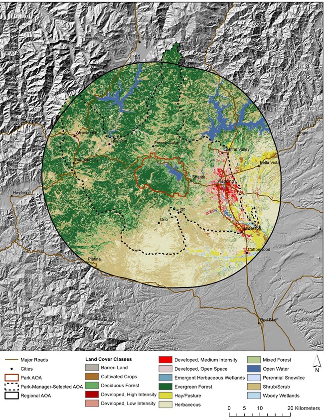
Land cover and land use monitoring provides landscape-scale information to all six parks in the Klamath Network. This protocol addresses changes in landscape composition and fragmentation surrounding parks. Understanding the spatial arrangement of park resources is important to identifying and evaluating opportunities for damage prevention and restoration, and determining potential threats to park resources.
Changes in landscapes can occur in response to both natural and man-made processes. Some parks are experiencing rapid suburban and rural development nearby. Most parks adjoin lands managed for timber production. These changes outside parks may affect resources within the parks, which is why the protocol monitors at both a park and regional scale.
Monitoring land cover and land use complements other Klamath Inventory and Monitoring Network projects by providing a broad view of park-wide and region-wide ecosystems.
Objectives are to:
- Determine the status and trends in the composition of land cover classes within parks and directly adjacent lands.
- Determine the status and trends in the configuration and connectivity of the land cover classifications.
- Determine the status and trends in human populations near the parks.
We measure:
- Conservation Status Percentage & Total Protected Area
- Conservation Status Percentage & Total Ownership
- Area/Percentage in Land Cover Types
- Impervious Surface
- Morphological Pattern Analysis
- Landscape Pattern Patch Size by Cover Type
- Landscape Pattern Distribution of Patch Sizes for Cover Types
- Landscape Pattern Density Analysis of Cover Types
- Housing Density
- Recent Change in Housing Density
- Total Population
- Population Density
- Recent Population Change
- Road Density
- Road Length
- Distance to Roads
- Area without Roads
- Natural vs. Converted Land Cover
Monitoring Documents
Source: Data Store Saved Search 2327. To search for additional information, visit the Data Store.
Source: Data Store Collection 9282. To search for additional information, visit the Data Store.
Last updated: January 10, 2023
