National Park Service LogoU.S. Department of the InteriorNational Park ServiceNational Park Service
National Park Service:  U.S. Department of the InteriorNational Park Service Arrowhead
Grand Portage National Monument Pots of stew, potatoes, wild rice and vegetables simmer over hot coals in the kitchen's fireplace.
view map
text size: largest larger normal
printer friendly
Grand Portage National Monument
Reports and Studies
MHS archeologist Ralph Brown shown with Ojibwe assitants from Grand Portage.

NPS photo

In 1936 the MHS sent archeologist Ralph Brown to Grand Portage. With help from a Grand Portage Ojibwe crew, Brown defined the stockade line and discovered several foundations within it.

The first research at what would eventually become Grand Portage National Monument was spearheaded by the Minnesota Historical Society
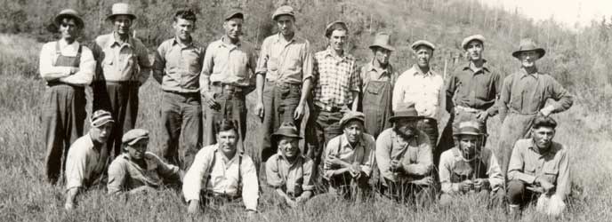
. In 1922 the MHS sent Dewey Albinson to Grand Portage, his main goal was to relocate the original footpath and draw maps of the upper "Fort Charlotte" end. With the aide of an Ojibwe guide, Dewey completed this and also composed a now famous image of Manitou Geezigance (little cedar spirit tree). In 1999 a new Division of Resources Management was formed at Grand Portage National Monument. Since then, new research and studies that have been accomplished are reflected in the PDF links below.

Archeology


History and Ethnohistory


 Natural Resources


Museum Collections


You are exiting the National Park Service website

Thank you for visiting our site.

You will now be redirected to:

We hope your visit was informative and enjoyable.

Drawing by C.W. Jefferys of David Thompson in Athabaska Pass 1810.

Did You Know?
The great geographer David Thompson mapped most of Canada and the northern U.S. west of Grand Portage (1794-1821) a tribute to the exploratory achievements of the Nor’westers.

Last Updated: May 30, 2011 at 11:12 MST