
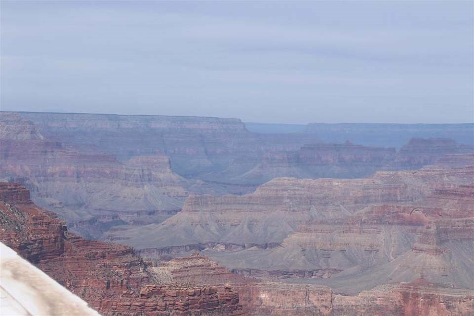
Clean Air and Clear Views?Grand Canyon is in the northwest corner of Arizona, close to the borders of Utah and Nevada. The Colorado River, which flows through the canyon, drains water from seven states, however the natural feature we know as Grand Canyon is entirely in Arizona. Visibility Comparison from Yavapai Point Webcam 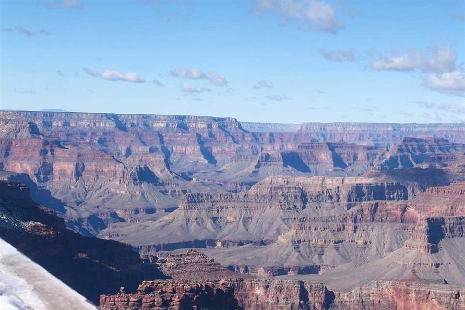
Left image
Right image

Webcam
Yavapai PointThe Grand Canyon National Park's Air Quality Webcam offers a window into the current sights, weather, air quality and seasonal changes that the park is experiencing. The view refreshes every 15 minutes. View WebcamGrand Canyon and the History of Visibility ScienceFor most of us, visibility is a subjective sense of how far and how well we can see across a landscape. And it really matters to most park visitors! After all, we want to see these beautiful places. But is there a way to measure visibility in a scientific way, with accuracy and precision? Some atmospheric physicists started figuring that out in the 1970s in the Grand Canyon. They succeeded, and today their methods allow governments worldwide to monitor visibility and enact policies to improve it by reducing air pollution.
Visit our keyboard shortcuts docs for details
Is there a way to measure visibility in a scientific way, with accuracy and precision? Some atmospheric physicists started figuring that out in the 1970s in the Grand Canyon. 
Grand Canyon National Park is one of only 49 Class I air areas managed by the National Park Service and is afforded the highest level of protection under the Clean Air Act. Grand Canyon is part of a network of air monitoring stations in almost 70 national parks.
Primary Pollutants of ConcernReduced air quality can occur year-round at Grand Canyon National Park from wildfire and regional air pollution. Ozone and particulate matter 2.5 microns and smaller (PM2.5) are the most harmful pollutants at the Park, particularly when performing more strenuous activities. Links:Live Weather & Air Quality Data (U.S. National Park Service) (nps.gov))EPA AirNOW: https://www.airnow.gov EPA’s Fire and Smoke Map (https://fire.airnow.gov) Historic Visibility Studies: Historic Visibility Studies in National Parks (U.S. National Park Service) (nps.gov) (includes GRCA – shows that areas as far as southern California contribute to visibility impairment at the Grand Canyon) Park Examples:Park Air Quality - Sequoia & Kings Canyon National Parks (U.S. National Park Service) (nps.gov) Current Air Quality and Smoke Monitoring - Yosemite National Park (U.S. National Park Service) (nps.gov) 
Webcam
Live View from Kolb Studio - Grand Canyon VillageIn this north-facing view, the Battleship formation is in the center, and Havasupai Gardens (formerly known as Indian Garden) is visible - lower right, 3000 feet (915 m) below. Kolb Studio was the family home and photography studio of the Kolb Brothers, pioneer photographers at Grand Canyon. Verify that the time and date of the picture is current (upper left in image) Camera is hosted by Grand Canyon Conservancy. The image updates every minute. View Webcam |
Last updated: July 10, 2023