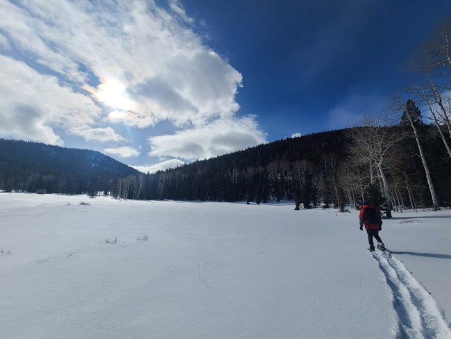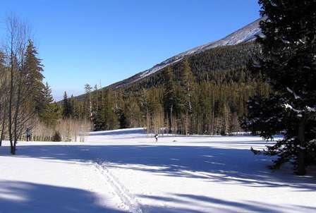
B. Mills Experience Winter in the DesertSolitude, stillness, and spectacular scenery greet visitors to Great Basin National Park in the winter. This quietest season of the year offers some unique experiences in the park. The Wheeler Peak Scenic Drive and Baker Creek Road are both closed to vehicle traffic, but open to skiers and snowshoers. Winter camping is available in the Lower Lehman Creek Campground, which remains open all year, or in the backcountry. Lehman Caves Tours are also offered year round, with the advantage of small group sizes during the winter months. Be aware of the unique safety challenges of exploring a remote winter environment. Please be advised that no food service exists in the park during the winter, and goods and services in Baker are limited. Skiing and SnowshoeingNovice skiers can find gentle slopes for touring or experienced ski mountaineers can challenge their skills on steep and deep backcountry runs. The Lehman Creek Trail is a popular destination for snowshoers in the park and is appropriate for all ages and skill levels. Trails and roads in the park are not groomed, though some routes are flagged with tape. Snow conditions range from wet or hard packed snow to fresh dry powder. For current snow conditions, email us or call (775) 234-7331. Snowshoe Loan ProgramVisitors should bring their own skiis, but snowshoes are available for free loan at the Lehman Caves Visitor Center in both adult and kid sizes. Limited pairs are available on a daily basis, so be prepared when visiting on a holiday weekend for snowshoes to be in short supply. Winter Backcountry CampingThe same regulations for camping in the backcountry during the summer apply in the winter. Day use areas, such as the Wheeler Peak area, remain closed to camping all year. Visitors may camp in the closed Wheeler Peak Campground during the winter at no charge. Winter Safety NeedsSkiing, snowshoeing, and camping offer memorable experiences at Great Basin, provided safety precautions are followed. For all winter trips, both day and overnight, registering at the visitor center and checking out at the completion of your trip is highly recommended. In such a remote area, this information is extremely useful in emergency situations. Special Winter ConcernsHypothermia, a condition in which a person's core body temperature is lowered, is always a potential danger. Wear proper clothing and be prepared for sudden changes in weather. Avalanches are common at high elevations in the Snake Range during the winter and spring. Many ski trails cross avalanche paths and run outs. Skiers should be alert for avalanche hazards, carry proper equipment, and check at a visitor center for current avalanche conditions before departing. In the BackcountryBackcountry travelers should always: 1. Prepare for the worst
2. Utilize terrain to your advantage
3. Minimize exposure time and use safe travel procedures
Ascending:
Crossing:
Descending:
STAY ALERT FOR CLUES AND INTEGRATE TERRAIN, SNOWPACK, AND WEATHER DATA EVERY STEP OF THE WAY. Here is a quick list of “must haves” when you are winter touring in the backcountry. Some equipment requires practice in order to use properly, especially avalanche beacons. Make sure you are skilled at using these items beforehand. Repair kit items should be simple and relevant. Items that have multiple uses (straps, cord, zip-ties, duct tape, etc.) are great and have numerous applications. Always carry:
In avalanche terrain, always carry:
Optional items:

NPS Winter Trail DescriptionsThe more popular trails and routes for skiing and snowshoeing in the park are described below. Trails are not groomed. In general, there are no flat or completely level trails. They all begin by climbing uphill, and include varying degrees of downhill to return to the trailhead. Trailhead elevations begin around 7,000 ft. Those routes that leave main roads may require map reading or orienteering skills, as not all trails are flagged. Know your abilities and limitations, and be sure to carry proper winter equipment and gear. Call (775) 234-7331, or stop at any visitor center, to inquire about trail conditions or for better directions. Grey Cliffs Group CampgroundDescription: This route begins at the barricade on Baker Creek Road, and follows the road through Grey Cliffs Group Campground to the trail between Grey Cliffs and Baker Creek Campgrounds. Make this a loop by skiing up to Baker Creek Campground, and then down Baker Creek Road back to the barricade. Pole Canyon/Timber Creek Loop TrailDescription: This route follows a summer hiking trail of the same name, forming a loop back to the trailhead by way of Baker Creek Road. This route begins at the barricade on Baker Creek Road. Proceed into the Grey Cliffs Group Campground then make the first left at the bottom of the hill towards Pole Canyon. Follow the road to the Pole Canyon Trailhead. The trail continues up a canyon, over a pass, and down the other side, to the Baker Creek Trailhead. From there, follow Baker Creek Road back down to the barricade. Wheeler Peak Scenic DriveDescription: This route follows the Wheeler Peak Scenic Drive from the point of the winter closure at Upper Lehman Creek Campground, to the Bristlecone Parking Lot at the end of the road. The lower portion of the road may have bare patches due to its south facing exposure, but conditions are almost always good for snowshoeing. Upper Lehman Creek CampgroundDescription: The road that loops through the Upper Lehman Creek Campground is a great beginner snowshoe or ski trail. You can reach the Lehman Creek Trailhead on this route as well. Lehman Creek Trail to Wheeler Peak Parking LotDescription:This route follows a summer trail. To reach the trail requires parking at the Wheeler Peak Scenic Drive barricade, and following the road next to the Lehman Creek Campground to the official trailhead. Note that camping is allowed in the Wheeler Peak Campground during the winter at no charge. Glacier/Bristlecone/Alpine Lake Cirque AreaDescription: Reaching this loop trail in the winter first requires skiing or snowshoeing the Lehman Creek Trail to the Wheeler Peak Parking Lot (see above description), which adds 6.8 miles roundtrip, in addition to the mileage below. Camping is not allowed on this trail, as it is part of the Wheeler Peak Day Use Area. Camping is permitted, however, in the Wheeler Peak Campground at no charge. Wheeler Peak 13,063 ft, Doso Doyabi 12,771 ft, and Bald Mountain 11,562 ftDescription: Reaching any of these trails in the winter first requires skiing or snowshoeing the Lehman Creek Trail to the Wheeler Peak Parking Lot (see above description), which adds 6.8 miles roundtrip, in addition to the mileages below. Be advised that overnight camping is not permitted in the Wheeler Peak Day Use Area. You may, however, camp in the Wheeler Peak Campground free of charge. For more information, visit our Wheeler Peak in Winter page. |
Last updated: March 15, 2024
