|
Fire plays a significant role in the ecosystems at Golden Gate National Recreation Area. The fire regime has varied over time in response to both climatic changes and human activity. The fire history of the landscape has been shaped by lightning, and the land management practices of Native Americans, ranchers, loggers, the military, developers and, most recently, the National Park Service. 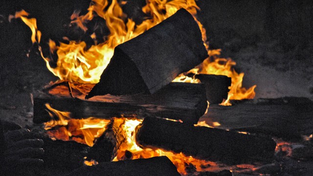
Current Fire Updates
Fire information on wildfires and prescribed fires in and around the GGNRA 
Fire Education
What is fire? What role does fire play in different ecosystems? The Golden Gate National Recreation Area's Office of Fire Management, in accordance with the Fire Management Plan, manages fire in such a way as to retain its beneficial effects in the ecosystem while protecting resources, property and lives. The goals of the Golden Gate National Recreation Area Fire Management Program are:
Fire Management Units (FMU) provide the framework for development of a wildland fire program. As directed by NPS Reference Manual-18: Wildland Fire (RM-18) (NPS 1999a), each FMU should be unique as evidenced by management strategies, objectives, and attributes; should be consistent with management goals and objectives found in land and resource management planning documents; and should avoid redundancy. In addition, the number of units should be kept to a minimum. Unit 1, Wildland Urban Interface (WUI) Unit 2, Park Interior Unit 3, Muir Woods National Monument Map of FMUs in Marin County (202 KB PDF) The Office of Fire Management monitors and responds to all wildand fires within the park and maintains an appropriate preparedness level in accordance with the park's Wildland Fire Step-Up Plan. The Golden Gate National Recreation Area's Fire Management Program is part of the San Francisco Bay Area Network.
415.289.1888 Office The Wildland-Urban Interface is the area where homes and wildlands meet. A wildland fire in this zone could threaten public safety and many homes. Golden Gate National Recreation Area includes many wildland areas where flammable vegetation flourishes next to homes. Many San Mateo and Marin County neighborhoods border park land and are areas where fire is a concern. In 1991, the Oakland Hills Fire destroyed over three thousand homes. Forty-five homes were lost to the Vision Fire near Point Reyes in October of 1995. Unfettered vegetation buildup fueled these fires. Such losses emphasize the importance of the National Park Service addressing Wildland-Urban Interface issues. To address the hazards related to the Wildland-Urban Interface, Golden Gate National Recreation Area manages fuels surrounding the interface. Protect Your Home from a Wildland Fire A wildland fire in this area could threaten hundreds of homes. Emergency resources may be spread thin and it's possible that fire crews may not be able to reach every structure. It is important, therefore, that homeowners take measures to protect their own home. In fact, California Law requires it. Fortunately, some simple steps can make a big difference. 
Defensible Space is the area around a home that can be landscaped in such a way as to reduce the chance that fire can reach the house. Fire uses vegetation like a road, and by removing or breaking up vegetation a homeowner can breakup or remove the paths that fire might use to get to the house.
These measures can reduce the chance that a fire might destroy your home. They also give emergency crews room to get in and defend your home. That's why it's called Defensible Space! Contact your local fire department for specific pointers on making your home more defensible. Also visit the Firewise Communities and FIRESafe MARIN websites for more information on reducing the wildland fire risk to your home. Fire danger ratings are determined daily during fire season. These ratings are based on the probability of ignition; the effects of wind, slope and fuel; and the potential energy released by a fire in the given weather and fuels. A daily rating of Low to Extreme fire danger is determined based on the worst case fire weather scenario during the hottest, driest part of the day on an open, south facing slope. Fire danger ratings may vary throughout the county and are used to determine whether land use restrictions will go into effect as well as how many firefighters should be available in case a wildfire does occur. Fire Danger Ratings describe the potential for fire to spread rapidly in a local area. Red Flag Warnings predict a weather event in which fire will be difficult to control. Red Flag Warnings are issued by the National Weather Service to notify fire agencies in advance of critical weather patterns that will contribute to extreme fire danger and/or extreme fire behavior. A Red Flag Warning is issued for the San Francisco Bay Area when there is a strong chance that Red Flag conditions will occur within the next 24 hours. When a Red Flag warning is issued, the Marin County Fire Department notifies public land owners who determine if land use restrictions will go into effect. These restrictions may include temporary road closures or suspension of special use permits. For information on Red Flag Land Use Restrictions, call public lands before visiting or call the Marin County Fire Department public information line at (415) 499-7191. Red Flag Conditions are wind events lasting at least 8 hours when vegetation is dry. Annual grasses are cured; no rain has occurred in the last 24 hours; and fuels 1/4 to 1/2 inch in diameter have less than 6% moisture. Relative humidity and wind speed during these events are as follows:
Red Flag Warnings and Fire Weather Watches will remain in effect through the expiration time noted in the forecast, or until canceled or upgraded. Red Flag Warnings and Fire Weather Watches are posted on the California Fire Weather web page and the website of the San Francisco Bay Area National Weather Service (NWS) office. Links to all fire weather planning forecasts, and other NWS office web pages can be found on the National Fire Weather Page, including the forecast for the San Francisco Bay Area. Fuels manangement is the manipulation of vegetation to reduce hazardous fuel and restore ecosystem health. Current fuels management is done in accordance with the National Cohesive Wildland Fire Management Strategy. The Strategy evolved from the National Fire Plan, which was initiated in 2001 and accelerated fuels management programs on all federal wildlands. Fuels management involves many different kinds of treatment:
| ||||||||||
Last updated: February 5, 2024