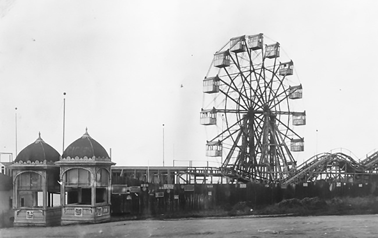
Photo courtesy of Greg Gaar Point Lobos Avenue, which began as a privately owned toll road, started at the intersection of Geary Boulevard and Presidio Avenue and continued west to the beach. The city designed the road for horse-drawn carriages and omnibuses and was a favorite racing road for horse drivers. Point Lobos Avenue made Lands End accessible to visitors from the inner districts of San Francisco. The Point Lobos Toll Road was a popular ride for visitors and no sightseeing trip was complete without a ride to the Cliff House. When other modes of public transportation began to reach Lands End, the toll road went out of favor. In 1887, the city removed the tollbooths and the road became a public thoroughfare, renamed Point Lobos Avenue. As a public road, Point Lobos Avenue continued as the main thoroughfare upon which the businesses, attractions, and residences of Lands End were located. The small stretch of road running from 48th Avenue down to the Cliff House and Ocean Beach was the site of the main developments in Lands End: the Cliff House, Sutro Baths, and Sutro Heights. It was also the route to Merrie Way, where Sutro’s Pleasure Grounds were located as well as the 48th Avenue Train Depot and Ocean Terrace. The stretch of Point Lobos Avenue between Presidio Avenue and 42nd Avenue was renamed Geary Blvd, in honor of the Gold Rush era San Francisco mayor. Today, Point Lobos Avenue begins at 42nd Avenue and runs west, curving down past the Cliff House to Ocean Beach where it turns into the Great Highway. Although many of its 19th and early 20th century attractions and businesses are gone, Point Lobos Avenue still offers plenty opportunities for fun as well as stunning views of the beach, ocean, and a gimpse of the fog shrouded Farallon Islands.
To learn more about the history of Point Lobos Avenue, please explore the following narratives: 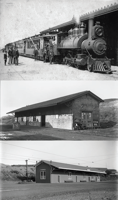
48th Ave. Train DepotThe Ferries & Cliff House Railway, often referred to as the Cliff Line, was a steam train line that gave San Franciscans access to Lands End for the moderate sum of only 5 cents.The Cliff Line’s inner terminus was at California St. and Presidio Ave. From there riders could transfer to cable cars that serviced the Ferry Building and downtown. To reach Lands End the Cliff Line followed a scenic route along the shore that offered views of the Golden Gate, Fort Point, and the Marin Headlands. From 1888 to 1905 the Cliff Line ended at a gable roofed wooden depot near the corner of 48th and Pt. Lobos Avenues, right across from the Sutro Heights main gate. The depot was remodeled in 1905 when the steam train line was converted to an electric streetcar. The 48th Ave. depot remained a stop on the streetcar line but the terminus was changed to the Sutro Depot, across from the Sutro Baths. Service to the 48th Ave. depot stopped in 1922 when the building was demolished to make way for today’s El Camino del Mar. Streetcars continued to run past the site for another three years until damage from landslides closed the line forever. 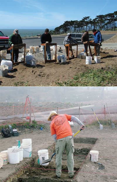
Archaeology at Lands EndLands End has been investigated by archaeologists from the National Park Service and the Golden Gate National Recreation Area (GGNRA) since at least 1976.These investigations at Lands End include both ancient and more recent sites. They include Sutro Heights features such as the observatory/tankhouse, the South Esplanade, flower carpet beds, the Parapet cellar, stables/boarding house and the South Gate entrance, as well as the Merrie Way stands, Ocean Terrace, and prehistoric Native American sites at Point Lobos. Archaeology at Lands End uncovers the important history of Lands End by filling gaps in our knowledge, discovering new and untold stories, solving mysteries, and highlighting small but important details of life over the years in this fascinating portion of San Francisco. The artifacts and features found by archaeologists help us understand the daily lives of the people who lived and worked in the area, and how the Lands End environment has changed over time. 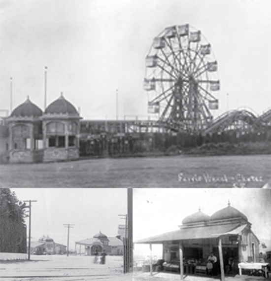
Merrie Way Concession StandsAdolph Sutro’s Pleasure Grounds, otherwise known as Merrie Way, would not be a true amusement park without a collection of vendors offering visitors a variety of goods for sale. Nine small concessions lined the north side of Cliff Avenue (now Point Lobos Ave.) near the midway, offering fresh roasted peanuts, fruits, candy, drinks, and other refreshments to visitors looking for more casual alternatives to the formal dining of the Cliff House.Like most of the attractions at Merrie Way, the concession stands were remnants of the 1894 Midwinter’s Fair of San Francisco purchased by Sutro at the close of the fair. The Merrie Way concession stands were housed in the fair’s reused Mudjar-roofed buildings. These included a produce and refreshment stand run by the Antipa family (Stand O), an Oyster and Chop House (Stand S), and a cigar shop (Stand U). The stands began operating around 1895 and were as short lived as Merrie Way, most of them closing by the early 1900s. 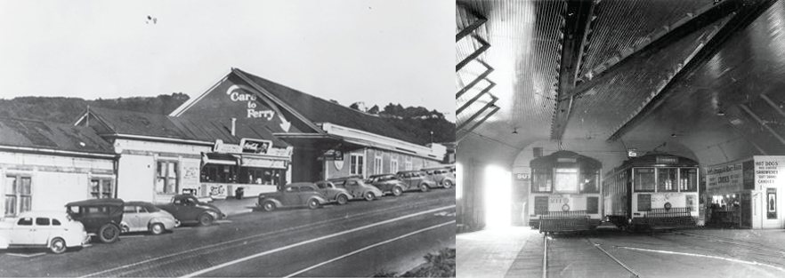
Sutro DepotThis wooden train station, built in 1896 near the entrance to Sutro Baths, served as the terminus for Adolph Sutro’s electric streetcar line known as the Sutro Railroad.A covered pedestrian walkway led visitors from the depot directly to the entrance of the baths. Inside was a hot dog stand, a few benches, and advertising panels. The United Railroads Company bought the Sutro Railroad in 1900, which then became the #2 Line. Service to Sutro Depot continued until 1949 when a fire destroyed the station. The depot was not rebuilt and service to Sutro Baths was terminated. 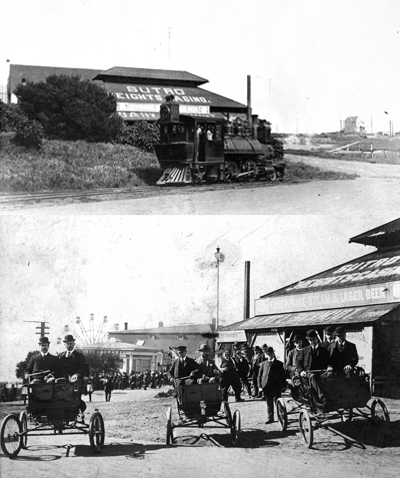
Sutro Heights CasinoThis ambitiously named but poorly documented Ocean Terrace saloon operated on the corner of Point Lobos and 48th Avenues.The establishment was first run by Herman Schmidt, ironically nicknamed “Baby Schmidt” because he weighed over 400 lbs. and was thought to be the heaviest man in California at the time. Schmidt ran the Sutro Heights Casino from 1897 to 1907. It was then bought by Oscar Olsen who ran the establishment under the name Cafe O.B. Olsen’s from 1908 to 1910. Olsen was proprietor when the Sutro Heights Casino was robbed in 1909. Olsen sold out to William Apple who closed the establishment in 1914, following the example of many other local businesses. 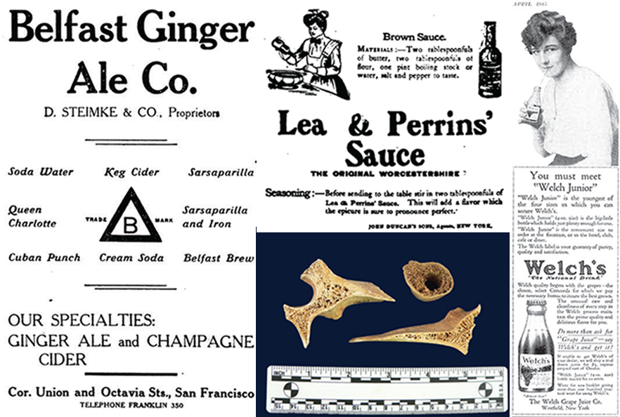
Food and Drink at Merrie WayArchaeologists working at the site of the Merrie Way stands from 2008-2012 uncovered a wealth of food related artifacts. These reveal the eating habits and brand preferences of residents and visitors of Merrie Way between 1895 and about 1905. Oyster and shrimp cocktails were popular, as evidenced by Bohemian Cocktail and Supply Company bottles. It is said that the oyster cocktail was invented in San Francisco in the 1860s when a hungry miner decided to mix a bowl of oysters with an improvised concoction of whatever seasonings were at hand.Condiments were widely used in the 19th and early 20th centuries in order to flavor bland food and tenderize tough cuts of meat. Remnants of condiments that were used with oysters and steaks were found by archaeologists near the oyster and chop house at Merrie Way. These include familiar Worcestershire and Tabasco sauce bottles. A great variety of soda water bottles were found, representing several San Francisco companies: Bay City Soda Water Co., Majestic Bottling Co., Belfast Ginger Ale Co., Breig&Schafer, and the Pioneer Soda Water Co. Welch’s and Welch’s Junior grape juice bottles were also found in abundance. Developed by a dentist and communion steward as a substitute for communion wine, Welch’s grape juice became a national favorite after thousands of people were introduced to it at the 1893 Chicago World’s Fair. 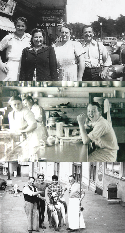
Louis’Louis’ Restaurant was officially opened by Louis and Helen Hontalas on a small piece of land rented from Adolph Sutro’s nephew on February 14, 1937.The small but famous café stands on the spot where a covered pedestrian walkway once connected the Sutro Depot to Sutro Baths. In the ensuing decades this unassuming restaurant has become a San Francisco icon. In 1973 the National Park Service acquired the land on which Louis’, the Cliff House, and the Sutro Baths ruins are located. Louis’ Restaurant became a concessionaire of the National Park Service and a part of the Golden Gate National Recreation Area. Louis’ has been remodeled three times in the many years since its opening: once after a fire destroyed Sutro Depot and caused damage to the restaurant in 1948; a second time in 1974-1975 during which the kitchen, restroom and most of the dining room were relocated, creating the footprint of Louis’ today; and again in 2011 after the restaurant signed a contract with the National Park Service allowing it to continue as a concessionaire for another 10 years. 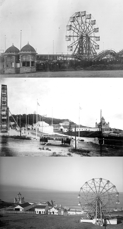
Merrie WayAt the close of the Midwinter Fair of 1894, many of the buildings and attractions were sold at auction. Adolph Sutro bought several rides and attractions to construct his own “Pleasure Grounds” above Sutro Baths, where the Lands End Lookout parking lot is today. American amusement parks became popular in 1895 after George Tilyou transformed Coney Island from a seedy place of ill repute to a controlled access venue that provided mechanized rides and thrills. This was the template for many successful American amusement parks.The amusement park boom lasted into the 1910s. It was inspired by the popularity of World’s Fairs and Expositions that were organized in cities throughout the country. This success can also be partly attributed to the availability of cheap public transportation and the increase in leisure time due to new labor standards. By 1898, Sutro’s Pleasure Grounds included such rides as the Mystic Maze, Haunted Swing, Swings on a Platform, Scenic Railway, and the iconic Firth Wheel. The grounds also had concession stands built from the Midwinter Fair kiosks. These sold food and souvenirs along Merrie Way and Point Lobos Road. Sutro’s Pleasure Grounds, or Merrie Way, did not last long. By 1900, many of the amusements and attractions were in disrepair or closed. The last large vestige of Merrie Way disappeared when the Firth Wheel was removed in 1911. The street sign marking Merrie Way can still be seen at Point Lobos Road near the Lands End Lookout Visitor’s Center. 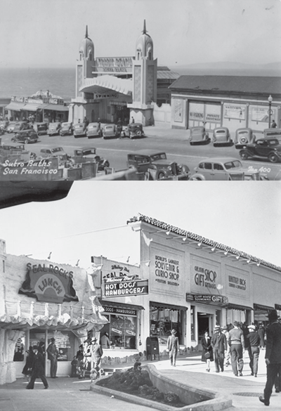
Point Lobos Ave. BusinessesThe buildings adjacent to the Cliff House and Sutro Baths on Point Lobos Avenue housed a variety of businesses beginning in the early 1910s.The 1913 Sanborn Company map made for fire insurance purposes shows 11 addresses on Point Lobos Avenue that held various shops and restaurants. The San Francisco City Directories of the 1920s list confectionaries, curio shops, an arcade, photo shop, and restaurants on the 1000 block of Point Lobos Ave., in an unbroken line of buildings extending from Merrie Way to the Cliff House. This block of buildings, which completely obstructed the view of the ocean, remained along Point Lobos Ave. until 1949. In the 1930s the businesses on Point Lobos Ave. included Louis’ Restaurant, which is still in operation today. The 1940s and 1950s saw the addition of the Pronto Pup hot dog stand and the memorable Cliff House Gift Shop. After the Cliff House was remodeled in 2006, Louis’ Restaurant and the Cliff House gift shop were the only businesses remaining on Point Lobos Ave. 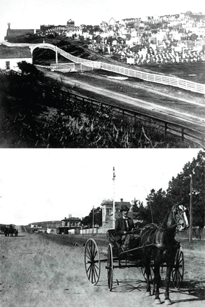
Point Lobos Toll RoadThis privately maintained toll road was built in 1863 by Dr. H. Gates. The road started at what is now Geary Blvd. and Presidio Ave. and ran west towards the Cliff House. Toll booths were erected at Geary Blvd. and Presidio Ave., at Sixth Ave., and at the beach.The road was used by horse drawn carriages and omnibuses, and made Lands End and the Cliff House far more accessible. It quickly became a very popular road for visitors and no sight-seeing trip was complete without a ride over Point Lobos Road to the Cliff House. According to a 1907 San Francisco Call article, part of the road was also a favorite racing spot for speedway drivers in the 1860s. The toll road was turned over to the City of San Francisco in 1877 and became a public thoroughfare. The road was renamed Geary Blvd. (in honor of a former San Francisco mayor) from Presidio Avenue to 41st. Avenue where it becomes Point Lobos Ave. |
Last updated: May 13, 2022
