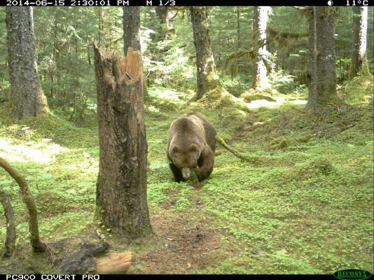
National Park Service LogoU.S. Department of the InteriorNational Park ServiceNational Park Service
National Park Service:  U.S. Department of the InteriorNational Park Service Arrowhead
Glacier Bay National Park and PreserveBald eagle makes a spectacular catch!
view map
text size:largestlargernormal
printer friendly
Glacier Bay National Park and Preserve
Bear Habitat and Campsite Risk Assessment

Learn More About the Bears of Glacier Bay
Traveling Safely in Bear Country

For the most current update on bear habitat research in Glacier Bay, click here [1.6 MB] .

 
Assessing campsite in front of McBride Glacier

Project Goals
To minimize bear/human conflict by collecting information that can be analyzed to predict areas where people are most likely to encounter bears, and using the results to reduce the likelihood of conflicts between people and bears in Glacier Bay.

For a full description of this project and some preliminary results, see the Alaska Science Center's Bear Project web page.

Background
Kayaking is the most popular wilderness activity conducted in Glacier Bay ’s extensive backcountry. Kayakers generally stay several nights while on extended trips, camping in the narrow belt of terrain between the ocean and often thick brush. These shorelines are also home to both brown bear (Ursus arctos) and black bear (Ursus americana ) populations as suitable bear habitat continues to expand in the wake of the glaciers' retreat. Humans and bears inevitably find themselves competing for the same narrow beachfront zone, where scenic camping opportunities coincide with prime bear foraging areas.

With increased human presence, the number of bear incidents has risen markedly over the last decade. (A bear incident is defined as damage to property and/or the reported use of bear deterrents (e.g. bear spray, flares, etc.). In addition, increased human presence may be displacing bears from food sources and/or travel routes important for their survival and reproductive fitness. While no human injuries have resulted from these incidents, park management is concerned for human safety as well as for the continued viability of bear populations in the park.


Project Summary
Two-person crews kayaked along Glacier Bay ’s beaches in the summers of 2001 and 2002, visiting campsites and assessing their risk factors for bear encounters. Technicians have surveyed 120 beaches for signs of bear use, and have conducted risk assessments at 162 campsites throughout the bay. At each site they have recorded bear sign and bear habitat potential along with other site characteristics. The data will help biologists gain an understanding of bears' use of these campsites, and will provide park managers with recommendations on how to reduce bear/human conflicts.

Project staff are currently in the process of entering field data from the past season into databases that will enable it to then be analyzed. Results will be presented in a report to the park as well as in an article for submission to scientific journals. Eventually this information will be placed on the park’s website, so prospective visitors can access it when planning their kayak trips in the bay. This work will provide Glacier Bay park managers with the information needed to more effectively manage backcountry areas for both people and bears.Ultimately, information gained by this project will be incorporated into a park bear management plan. This information will enable resource managers to:

  • Identify those attributes (e.g., proximity to salmon streams, bear food resource availability, etc.) associated with areas of chronic bear-human conflict.
  • Direct human activity away from high quality bear habitat to maximize camper safety and minimize disruption of natural bear activity patterns.
  • Develop standard bear management procedures to be incorporated into a park bear management plan.

Project Methods
We first determined the high-use camping locations in Glacier Bay by analyzing results of the voluntary backcountry survey, in which campers report where they camped each night of their trip. Beginning in the summer of 2000, teams of biologists kayaked through Glacier Bay visiting and evaluating high-use campsites and mapping bear sign in the vicinity of these sites.

Campsites were evaluated and rated on the following factors:

Quality of Bear Habitat
We assigned a broad vegetation description to each campsite and recorded the presence and relative abundance of key bear forage items, including plant and animal matter found on the shoreline as well as adjacent intertidal zone organisms. We assumed that the quantity of bear forage resources around a campsite is a reliable estimator of habitat quality, and that habitat quality is strong predictor of bear activity in the area. To affirm the seasonal food habits of bears using campsite areas, we attempted to identify major food items found in scats while in the field.
(For a listing of the plant forage species likely involved in seasonal diets of Glacier Bay bears, see bear foods).

Bear Travel Concerns
Travel concerns include physical features that influence the likelihood of a bear traveling through a campsite or surrounding area. These include geographic features such as valley junctions and constrictions in terrain, as well as features such as rock outcrops, cliffs, cut banks, steep slopes, moraines, islands, and peninsulas. The location and proximity of wildlife trails and potential travel routes are also documented under this category.

Visibility & Other Sensory Concerns
Visibility and other sensory concerns are features that may reduce the ability of bears and humans to detect each other. Visibility concerns include features such as dense vegetation and topography that may limit lines of sight, thus increasing the potential for surprise encounters.
Other sensory concerns include site windiness as well as noise from streams, creeks, waterfalls and ocean wave action on adjacent beaches. These potential sources of noise may affect the ability of bears and humans to detect and avoid each other.

 
Bear 'mark trail' in rye grass

Bear Sign
We recorded all bear sign, fresh and old, as evidence of use. Sign includes tracks, scats, feeding "digs," trails, mark trails (pictured at right), mark trees, and beds. We used bear sign as an index of bear use at and adjacent to campsites. Some types of bear sign are more obvious at certain campsites than at others. For example, tracks are more obvious at campsites that have sand or mud than at campsites with harder substrates. Similarly, some beaches undoubtedly retain tracks longer than others because of less intense wave/wind action. Consequently we do not assume that little recent bear sign at a campsite indicates that the campsite has little use by bears. Because of the inequalities in detecting and observing bear sign, less emphasis is placed on bear sign than on habitat potential or travel, visibility, and other sensory concerns.


Overall Campsite Description
Following our on-site investigations, we rated relative habitat potential, travel concerns, and visibility and sensory concerns for each campsite. Additionally, an overall rating of the campsite will be assigned relative to other campsites for both the potential for bear/human encounters as well as the potential for bear displacement. These final ratings will be an integration of all the factors considered, and will incorporate the biologists’ knowledge and experience with bear behavior and habitat use.

Expected Results and Products
This work will provide several products to park managers:

  • Evidence of bear use at or near high-use camping locations in the form of GIS-generated maps.
  • An assessment of bear-encounter risk potential for sites frequently used by kayakers in the park
  • A quantitative assessment of actual bear encounter rates at sites of varying risk levels.
  • A summary report which presents this information in a format which can be used by park managers for making well-informed management decisions as well as for educating the public.
  • A presentation to park managers upon project completion which presents findings and discusses their significance and application.

For more information about bears:

The International Association for Bear Research and Management


Lupine Buds  

Did You Know?
Lupines are hardy pioneers typically growing in areas with nutrient poor soil, like those of a retreating glacier. The fine hairs on their stems and the undersides of their leaves help to deflect wind and retain heat for more favorable growing conditions.

Last Updated: October 02, 2008 at 15:11 EST