Historic Preservation
The National Historic Preservation
Act became law on Oct. 15, 1966. Congress noted “the historical
and
cultural foundations of the Nation should be preserved as a living part
of our community life and development in order to give a sense of
orientation
to the American people.” Preserving archaeological sites, and historic
buildings and landscapes must take place within the context of the
evolution
of American communities. Making this concept a reality is no easy task.
It involves balancing community needs for new housing, sewage treatment
plants, hospitals and shopping centers with the need to protect
historic
courthouses, ancient ruins and Civil War battlefields. To succeed, we
try
to understand the relationships between community values and historic
resources.
We often define these relationships by their spatial proximity, or
location
of geographic features to each other. GIS is the perfect tool to
highlight
these spatial relationships.
National parks are, in a sense,
communities.
They require roads, visitor centers, pipelines, bridges, and utilities,
just like the hometowns we leave behind for vacations in our national
parklands.
Like many communities, parks are coping with the pressures of increased
population, as visitors bring more RVs, boats, tents, stoves, and pets
into the parks. The National Park Service preserves parklands for our
benefit
and enjoyment, as part of its mission. Yet the popularity of national
parks
has strained the agency’s ability to protect cultural resources. To
ease
this stress, park managers use high-tech tools, including GIS, to
balance
visitor use and cultural resource preservation. For example, GIS
software
can create maps that show the spatial relationship between a proposed
campground
and a historic site, or between a planned highway and a Revolutionary
War
battlefield.
With each success, the National Park
Service
increasingly embraces GIS to define relationships between park
management
needs and historic preservation. At Fort Smith National Historic
Site in Arkansas, researchers combined GIS with historic maps to
identify
archaeological sites. At Salinas Pueblo Missions National Monument in
New
Mexico, historians used GIS to help stabilize Pueblo and Spanish
ruins.
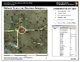
Wilson’s Creek National Historic Battlefield mapped the possible
location
of two artillery positions to interpret the Civil War battle for
visitor
education and enjoyment. In the Northeast, the park service linked
cultural
resource databases with GIS to deliver a complete body of information
on
each cultural resource. And the Park Services’ Cultural Resources GIS
Facility
used GIS technology to survey more than 800 sites related to the
Revolutionary
War and War of 1812, to assess their condition. In these and other
projects
nationwide, GIS has made important links between cultural resources and
park management. These relationships are essential if park managers are
to make historic preservation a living part of the communities they
serve.
John J. Knoerl, Ph.D,
Program
Manager
Cultural Resources GIS Facility
National Park Service
Articles:
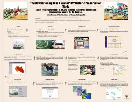
Carl Drexler, Wilson's Creek NB
Using GIS to Identify Possible
Artillery
Positions and Manage Artifact Data at Wilson's Creek National
Battlefield
The first major battle of the Civil War
west of the Mississippi River erupted Aug. 10, 1861, along a quiet
brook
near Springfield, Mo. There at Wilson’s Creek, an intense firefight
raged
for hours between Union and Confederate troops. More than 140 years
later,
archeologists from the Midwest Archeological Center are using GIS to
more
accurately pinpoint artillery positions and record the locations of
bullets,
shell fragments, and personal belongings that show where opposing lines
fought, and men died. GIS mapping helped historians reconstruct events
at Wilson’s Creek National Battlefield Park. In one instance, a GIS
analysis
of shell fragments suggested a more accurate position for Union
artillery
that surprised Confederate cavalrymen at the south end of Sharp’s Field
at dawn. In another, GIS mapping showed where a Confederate battery
routed
a union brigade at the north end of the field. This sort of analyses
has
become increasingly popular as a way to clarify and correct the
historical
record. GIS mapping has helped the NPS better understand and interpret
park history and present a more accurate and sophisticated view of the
battle to the public.
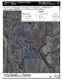
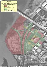
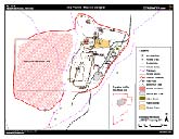
Artifact distribution on Bloody Hill
|
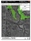
Viewshed analysis illustrating positions from which Bledsoe's Missouri
(CS) battery could have fired on Sigel's Brigade in Sharp's Cornfield
|
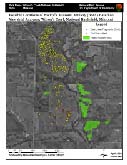
Viewshed analysis illustrating positions from which Backof's Missouri
Artillery (US) could have fired on the Confederate cavalry camps during
the opening stages of the battle.
|
|
Click for Technical Article
John Knoerl, National Center for Cultural
Resources
Mapping the Revolutionary War and War
of 1812
Yorktown, Bunker Hill and New Orleans
are
getting the once-over as the National Park Service takes another look
at
the battlefields of the Revolutionary War and War of 1812. With
congressional
support, the NPS set out to identify and preserve significant
battlefields
for future generations. With help from GIS and other high-tech tools,
the
NPS created an online database where scholars, researchers and the
public
could ask questions and make suggestions and corrections on potential
battlefields.
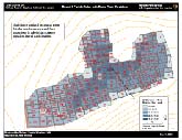
After reviewing all the information, experts selected 884 sites in 32
states
for field surveys. Over the next two years, surveyors from federal and
state agencies, universities, museums and private institutions mapped
the
battlefields, integrating GIS, the Internet, digital databases,
topographic
maps, laptops, and GPS. The resulting statistics and maps will shape
NPS
recommendations on battlefield preservation in its final report to
Congress
in (What year?).
Integration of GIS, GPS, Remote Sensing, and digital database
technologies
used to survey Revolutionary War and War of 1812 sites.
|
Click for Technical Article
Cheryl Sams, Northeast Region
Linking Cultural Resource Databases
through GIS
The National Park Service relies on
databases
full of cultural information about archeology, landscapes, historic
buildings,
museum collections, and characteristics and customs of different
peoples.
But until now, the NPS had no easy way to retrieve the data from a
single
location. Now thanks to GIS, the NPS can link the information kept in
separate
databases, putting data at the fingertips of park planners and
managers.
North Carolina State University’s Center for Earth Observation
developed
a method to determine the geographic relationship between each feature
in the databases, using an (x,y) coordinate system. The center then
built
a geographic information system by linking information from each
database
to the corresponding features. The GIS has made the information readily
available, allowing research queries and analyses based on information
drawn from any of the databases.
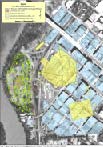
Cultural Resource GIS for Appomattox Court House
|
Click for Technical Article
Anne Vawser, Fort Smith NHS
Using Historic Maps to Anticipate and
Manage Archeological Resources in Fort Smith National Historic Site,
Arkansas
Fort Smith National Historic Site in
Arkansas
embraces the remains of two frontier forts and a federal courthouse.
The
government opened the first Fort Smith in 1817 to keep the peace
between
local Osage Indians and Cherokee who had been forced from their
ancestral
lands in the Southeast. The second fort opened in 1838 to deal with
ongoing
westward migration of Indians and settlers. The Federal Court for the
Western
District of Arkansas replaced the fort in 1871, after the Civil War.
The
court served as a buffer between outlaws and peaceful citizens and
handled
legal matters in the Indian Territory and Western Arkansas. The site
today
reminds visitors of 80 turbulent years in the history of federal policy
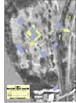
toward Indians. The National Park Service has completed a mapping
program
using GIS technology that included evaluation of more than 75 historic
maps. The project resulted in a digital atlas of more than 35
themes,
each showing a different kind of geographic information. The atlas will
help park managers and researchers avoid damage to archeological
features
in the park. And displays of the mapping process will offer visitors a
new and easier way to understand park history and the role of the forts
in the development of the West.
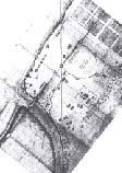
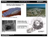
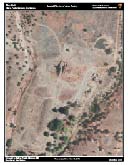
Historic map of the second fort at Fort Smith
|
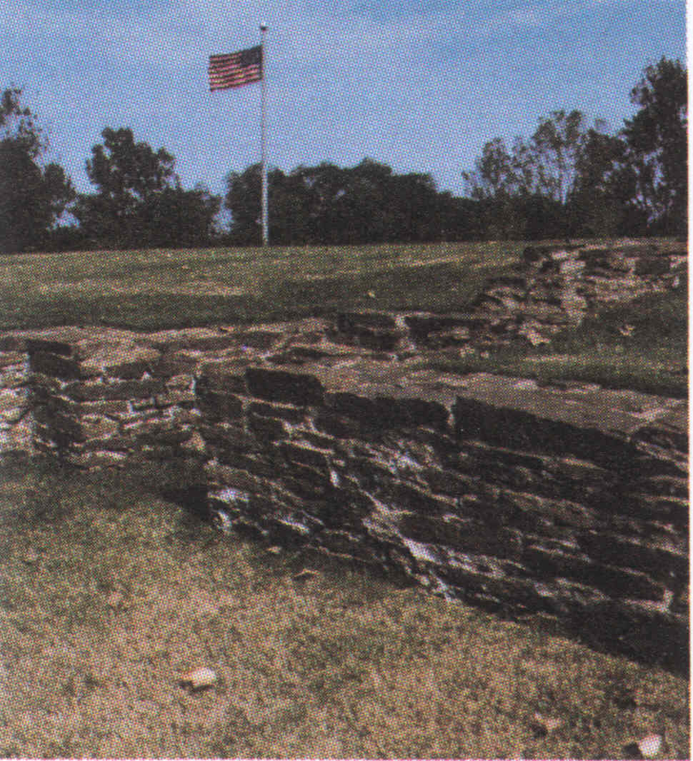
Photograph of part of the foundation of the first fort
|
Features of the first for derived from historic maps and the areas
that have been excavated
|
Historic features from various sources overlain on the current DOQQ
for Fort Smith
|
Areas of Fort Smith National Historic Site determined to be
archeologically
sensitive based on historic features and areas that have been impacted
by development
|
|
Click for Technical Article
Andrew Waggener, Salinas Pueblo Missions
NM
GIS in Ruins and Historic Structures
Preservation at Salinas Pueblo Missions National Monument
The austere yet beautiful reminders of
early contact between Pueblo Indians and Spanish explorers are visible
in the ruins found at Salinas Pueblo Missions National Monument in New
Mexico. The decades-long work to preserve their rich history now
includes
GIS mapping of pre-historic and historic features to manage and
automate
these resources. From stored databases, archeologists can retrieve
geographic
information and field assessment reports and select from thousands of
scanned
photographs as they work to preserve the ruins of four missions and
surrounding
pueblos. GIS projects illustrated in these maps involve digitized,
scanned
drawings of Pueblo and Mission structures, GPS data collection and
conversion
of computer-aided design data sets. GIS mapping, databases and
large-scale
aerial photography assist archeology and historians as they learn more
about the history of the Pueblo Indian trading communities that thrived
in this remote frontier country until the late 17th Century, when
drought,
famine and warfare drove the Spanish and their Indian allies south to
El
Paso.
Mound 7 Room Blocks and Walls
|
Four Views of Mound 7
|
Abo Pueblo Mission Layers
|
Abo Visitor Area on Aerial Photo
|
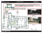
Abo Mission Complex with Photos
|
|
Click for Technical Article