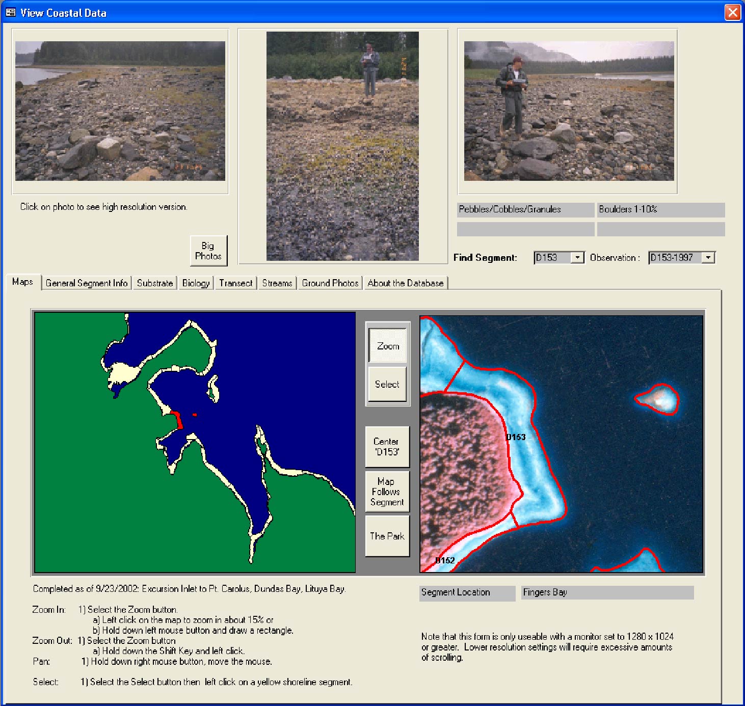
View of database showing the map tool that allows the user to select a shoreline of interest. The view shows the location of a selected shoreline segment polygon and displays its infrared aerial photo and ground photos taken at the segment.