

Geography and our identification with it, give us a sense of place. Geography also affects our national identity, and for many National Parks is the fundamental reason for their establishment as parks. Therefore, the application of geographic concepts to park management and public education about parks is a natural step. Geography provides the framework, the lines of latitude and longitude, a unique position on the Earth's surface from which park resources can be studied and related.The modeling of landscapes can give us valuable information about the park ecosystem or historical setting, and help us visualize how it will look in the future under various management strategies... MORE->>
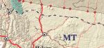
You can map the National Trail System and other outreach programs using the state pages on NPS.gov Learn more about State Pages webmaps.
| ParkNet | US Department of the Interior | FOIA | Privacy Policy | Disclaimer | FirstGov |