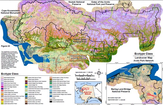
Ecotype Class Landcover Map
These maps and others are the products of an eight-year effort (2002-2009) by ABR Inc. - environmental Research & Services as contracted by the Arctic Network of the National Park Service to survey, compile, analyze, and map ecosystems across the five parks of the Arctic Network. This work was published in a Natural Resource Technical Report: An Ecological Land Survey and Landcover Map of the Arctic Network The Arctic Network is comprised of the following parks: Gates of the Arctic National Park & Preserve, Noatak National Preserve, Kobuk valley National Park, Cape Krusenstern National Monument, and Bering Land Bridge National Preserve. |
Last updated: April 30, 2018
