|
Visit our keyboard shortcuts docs for details
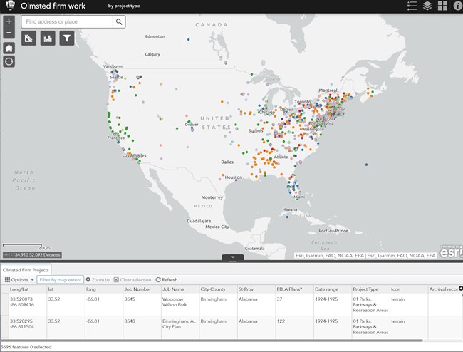
Check out the work we have been doing to visually represent the work of the Olmsted firms. Based on historic records from our archives as well as sources outside of our collections, we've gathered the longitudes and latitudes of many of the firm's projects and compiled them into a searchable map. 
Mapping the Work of the Olmsteds in the World: What's in Your backyard? Recently we have been collecting data to visually represent the work of the Olmsted firms. Based on historic records from our archives as well as sources outside of our collections, we've gathered the longitudes and latitudes of many of the firm's projects. We've created a Google Earth layer that shows the various types of projects - public parks, cemeteries, and private estates, for example - and includes data such as project name, location, number and date range of historic plans, and the Olmsted job number, which is essential to doing research in the archives. More about the Olmsted archives can be found elsewhere at our website and at the Olmsted Research Guide Online - or ORGO - at www.rediscov.com/olmsted. The complete Master List of Olmsted projects can also be found there. To access this layer, you must have Google Earth (earth.google.com) already installed on your computer before opening the file. To use this file, simply open this .kmz file and it should automatically open in Google Earth, or else you can simply save the file to your computer. The layer allows you to see all of the project types at once, or select specific project types to view (don't forget to "Save my places" at the "File" menu so you won't have to download the .kmz file each time). This work is still ongoing, and while there's much more data to be added, we decided to put as much up as possible rather than wait for a "final" version. Because of that, there may be some errors in the data and we'd love to hear from you, our users, if you find mistakes (e-mail us). Also, if you find a project in the Master List not represented on this map, and you have evidence of where it is located, please feel free to drop us a note with location and citations and we'll look into it! It should also be noted that while every effort has been made to get as specific a location as possible, some areas are too general (city planning and park system projects are good examples of this) and so, some projects have only been generally located. Additionally, some projects never proceeded beyond the purely theoretical and existed only as concepts. If there was any evidence found, however, of a physical locale for a project - built or not, currently "Olmstedian" or not - it was tagged with a location. (A sizable and ever-growing keyword-searchable document with research notes and found citations can be accessed here.) Most of all, we hope you enjoy this product. Please write to us and let us know what you think! Our interest for this project was in getting more people aware of the national (and international) scope of the Olmsted work "on the ground". Another hopeful outcome is that our visitors become more aware of the Olmsted legacy right in your own backyard. The Olmsteds helped define American landscape architecture and their work continues to inspire the legions who realize that nature is one of the best pathways to health and happiness and is essential to community development. And so we ask: do you know what's in your backyard? |
Last updated: February 28, 2024
