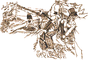
National Park Service LogoU.S. Department of the InteriorNational Park ServiceNational Park Service
National Park Service:  U.S. Department of the InteriorNational Park Service Arrowhead
Fort Necessity National Battlefield National Road map detail
view map
text size: largest larger normal
printer friendly
Fort Necessity National Battlefield
The National Road
 

The National Road, today called U.S. Route 40, was the first highway built entirely with federal funds. The road was authorized by Congress in 1806 during the Jefferson Administration. Building on the National RoadConstruction began in Cumberland, Maryland in 1811. The route closely paralleled the military road opened by George Washington and General Braddock in 1754-55.

By 1818 the road had been completed to the Ohio River at Wheeling, which was then in Virginia. Eventually the road was pushed through central Ohio and Indiana reaching Vandalia, Illinois in the 1830's where construction ceased due to a lack of funds. The National Road opened the Ohio River Valley and the Midwest for settlement and commerce.
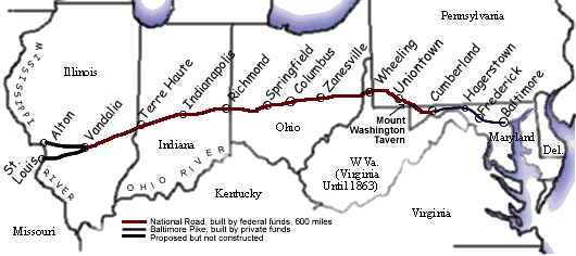
continue...

 
Map of Historic National Road
The National Road linked the eastern and western states in the first half of the 19th century, running from Cumberland, Maryland to Vandalia, Illinois.

You are exiting the National Park Service website

Thank you for visiting our site.

You will now be redirected to:

We hope your visit was informative and enjoyable.

Last Updated: April 11, 2008 at 10:17 MST