The geology at Dinosaur National Monument is a feast for the mind and for the eye. The landscape and scenery at the monument reflect the tremendous geological forces--pressure, deposition, uplift and erosion--that shaped this area and that are constantly at work on our dynamic earth. Because Dinosaur receives less than 12 inches of precipitation a year, vegetation is thin and the rock layers and the geologic features are clearly visible. Geologic Setting 
NPS/Mike Weinstein Deposition The rock layers at Dinosaur make up one of the most complete stratigraphic columns exposed within the National Park System. With the exception of the Ordovician and Silurian, all of the geologic periods are represented in the Dinosaur area. Almost all of the rocks exposed in the area are sedimentary and range in age from Precambrian (about 1,100 million years ago) to Miocene (about 25 to 10 million year ago). 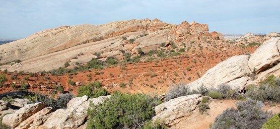
NPS 
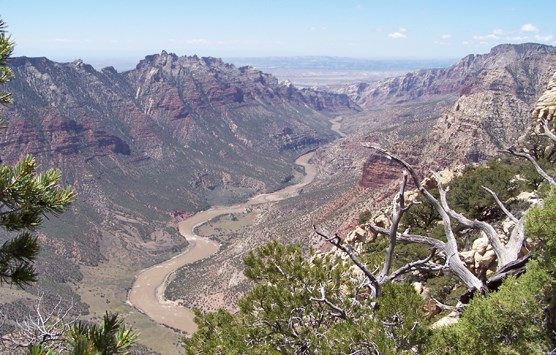
NPS Uplift At Dinosaur, the mountain-building did not simply push up the rock layers from below, but also squeezed them from the sides, warping and lifting them, sometimes cracking and shifting them along fault lines. Throughout the monument, much of the spectacular scenery--the faults, folded and uplifted rock layers, and river canyons more than a thousand feet deep--reflect the tremendous geological forces that shaped this area. Erosion Geologists call the process of canyon formation downcutting. Downcutting occurs as a river carves out a canyon or valley, cutting down into the earth and eroding away rock. At Dinosaur, canyon walls reveal textbook examples of folded and faulted rocks formed during the past two billion years. Many of the 23 rock layers exposed within the monument are visible only in the river canyons. Without the slow, persistent downcutting of the Green and Yampa, these impressive, colorful rock layers would lie buried deep beneath the Earth's surface 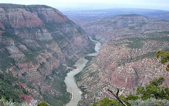
NPS |
Last updated: March 8, 2024