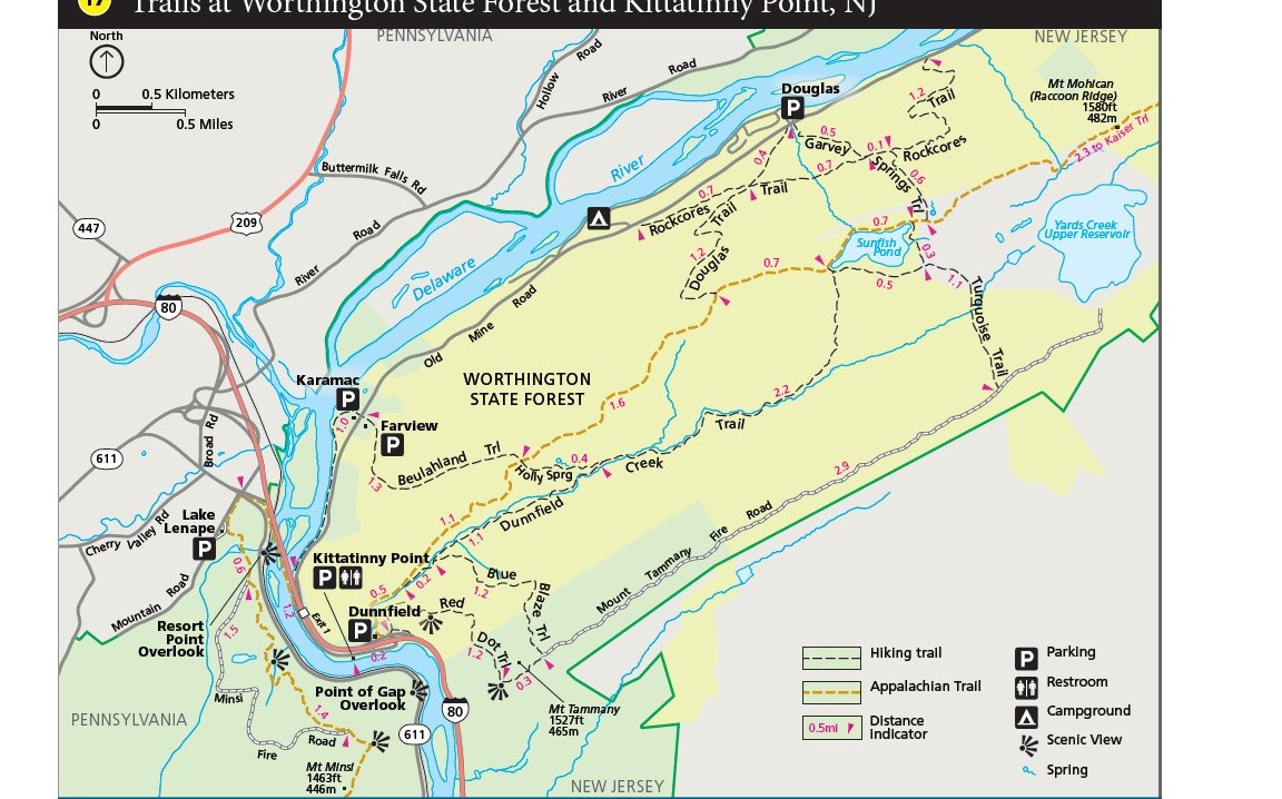
NPS Map Length: 3.5 miles, one-way This trail is in the Dunnfield Creek Natural Area. Dunnfield Creek is a designated Wild Trout Stream and supports a healthy population of native brook trout. The trail follows the stream through a mature hemlock and mixed hardwood ravine. Numerous small cascades are seen along the creek. Be prepared for numerous stream crossings. The trail ends at Sunfish Pond, a natural glacial lake. Over twenty miles of trail can be connected together in the Worthington State Forest area to fill the entire day. Other Information: restroom located at trailhead;the trailhead parking lot fills quickly on summer weekends; more information about Worthington State Forest Other trails in Worthington State Forest: |
Last updated: August 17, 2021
