|
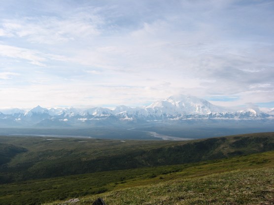
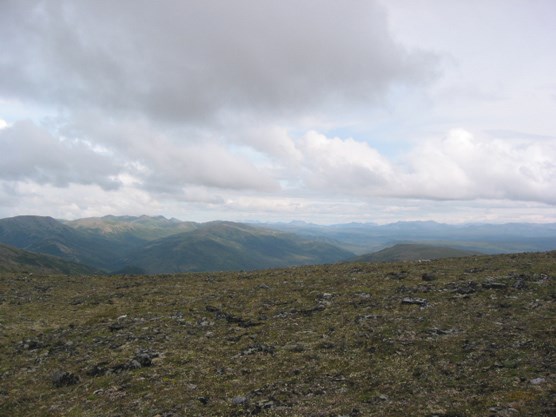
UNIT 43 Description: At the southwestern end of the Kantishna Hills, the rounded ridges of this unit are the last high ground before the expanse of lowland spruce forest that is common in the western portions of the park. The hillsides and stream bottoms that surround the open ridge tops are often covered with thick stands of alder and willow. The area has a significant gold mining history so old roads, equipment, trails and landscape disturbance are still visible. 
NPS Photo Tips/Special Features: Outstanding views of Denali and the Alaska Range are possible from the ridge tops. Signs of human use, both modern and historic, are everywhere. Several private lodges lead guided hikes in the area so expect to see larger groups of visitors. Blueberries are abundant and tasty in the fall. Access: It is a 6 hour bus ride out to Kantishna and the end of the Park Road. To access most of this unit, you need to cross lower Moose Creek. One common crossing is near Eureka Creek, just past the Kantishna Roadhouse, which puts you onto the El Dorado Creek mining road on the west side. Do not cross private property, including the land owned by the lodges, without permission. A crossing of Moose Creek is not required to get into the southeast corner of the unit around Busia Mountain if you leave the road south of the bridge over Moose Creek. Once on the ridges, exploring and travel are relatively easy. Brooker or Busia Mountain can be ascended directly from the Moose Creek valley or from the southeastern corner of the unit, but the climbs tend to be slower and brushier than the routes coming up out of Eldorado Creek. Longer trips can be made by following the ridges south of Busia into Unit 15 and eventually Wonder Lake Campground. Additional Notes and/or Hazards: Moose Creek flows in a single channel and during periods of high water, it may be difficult to cross on foot. Mosquitoes are usually dense in this part of the park in June and July. There is a large “Day Use Only” zone in this area due to various private lodges and private property. Be sure to mark off this no-camping zone on your map and to camp out of sight of the Park Road and all the Kantishna lodges. Despite the modern development, it is still very easy to get disoriented on the large, flat ridge tops when dense clouds and fog blanket the hills. Make sure you have a compass and map and know how to use them. If you plan to hike in this unit, be aware that it is outside of designated Wilderness. In 1980, Mount McKinley National Park was expanded and renamed Denali National Park and Preserve and this area was included as part of the new park’s additions. The Kantishna Hills and surrounding area is a historic mining district dating back to the early 1900s. There are patented and un-patented mining claims in the area, private property and privately owned and operated lodges. People who have traditionally hunted, fished and trapped in the area continue to do so. The miners in this area established travel routes along ridges and in creek beds to access their claims. There are cabins, equipment, old roads and assorted refuse on public and private land in very remote areas. Hikers in the Kantishna Hills must respect private property and the cultural significance of the mining history. Do not disturb the historic relics and never enter a private residence without prior permission. If you obtain a backcountry permit for units 40 – 43, be sure to take the free hand-out from the Backcountry Information Center which explains the regulations and warnings pertaining to the Kantishna Hills. It may be unsafe to drink the water from the following streams due to heavy metal contamination: Eldorado, Slate, Friday, Eureka, Caribou, Spruce, Glacier, Stampede and Moose Creek below Spruce Creek. Water filters, boiling and chemical treatments are ineffective for treating water with heavy metal contamination. 
nps photo |
Last updated: September 1, 2015
