|
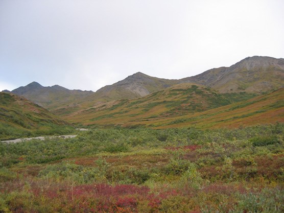
UNIT 41 Description: The broad, alpine tundra ridges and peaks of the Kantishna Hills are the primary feature of this unit. A number of small, brushy stream valleys interspersed with steep ridges lead down off of the main ridge system and feed into Caribou Creek on the north side and Moose Creek on the south. This unit has three prominent peaks in it, Glacier, Spruce and Kankone. 
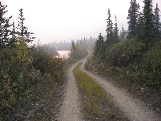
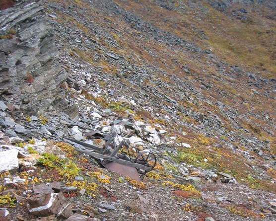
nps photo Tips/Special Features: Outstanding views of the Alaska Range and surrounding area are very accessible in this unit because of the easy travel along the ridge tops. The area has a significant gold mining history and old roads, equipment and landscape disturbance are still visible. Depending on your personal interests, this can either add to your hiking experience or detract from it. As with other units in the Kantishna Hills, the ease of access provided by the old roads is balanced with the significant human presence in the area. Access: There is no access from the Park Road into this unit and it takes at least one night of camping in another unit to reach this area. Access to the unit is primarily from the west through the routes described for Unit 42. On the south side of the unit is the old mining road up the Moose Creek valley. This can be used in combination with trips along the side ridges coming off the main ridge between Rainy and Spruce Creek. Following the old Moose Creek road from this unit to the Park Road will require about 15 crossings of Moose Creek. These can be difficult on foot due to the creek’s fast, single channel flow. If water levels are too high for these multiple crossings, it is also possible to travel cross country along the creek bottom and adjacent ridges. This travel will be slow and through thick brush, but it is a safer alternative during high water. The road mainly stays on the north side of the creek in this unit. 
nps photo It is possible to reach the headwaters of Clearwater Creek (Unit 40) by following streams up to Myrtle Creek, but the thick brush is extremely tiring and disorientating. Once you reach Clearwater Creek the traveling is easier. Another common access point to get to this unit is to start on the Park Road near the headwaters of Moose Creek (Unit 35) and follow the creeks or ridges north. Additional Notes and/or Hazards: Moose Creek flows in a single channel and during periods of high water, it may be difficult to cross on foot. Mosquitoes are usually dense in this part of the park in June and July. If you plan to hike in this unit, be aware that it is outside of designated Wilderness. In 1980, Mount McKinley National Park was expanded and renamed Denali National Park and Preserve and this area was included as part of the new park’s additions. The Kantishna Hills and surrounding area is a historic mining district dating back to the early 1900s. There are patented and un-patented mining claims in the area, private property and privately owned and operated lodges. People who have traditionally hunted, fished and trapped in the area continue to do so. The miners in this area established travel routes along ridges and in creek beds to access their claims. There are cabins, equipment, old roads and assorted refuse on public and private land in very remote areas. Hikers in the Kantishna Hills must respect private property and the cultural significance of the mining history. Do not disturb the historic relics and never enter a private residence without prior permission. If you obtain a backcountry permit for units 40 – 43, be sure to take the free hand-out from the Backcountry Information Center which explains the regulations and warnings pertaining to the Kantishna Hills. It may be unsafe to drink the water from the following streams due to heavy metal contamination: Eldorado, Slate, Friday, Eureka, Caribou, Spruce, Glacier, Stampede and Moose Creek below Spruce Creek. Water filters, boiling and chemical treatments are ineffective for treating water with heavy metal contamination. 
nps photo |
Last updated: September 1, 2015
