|
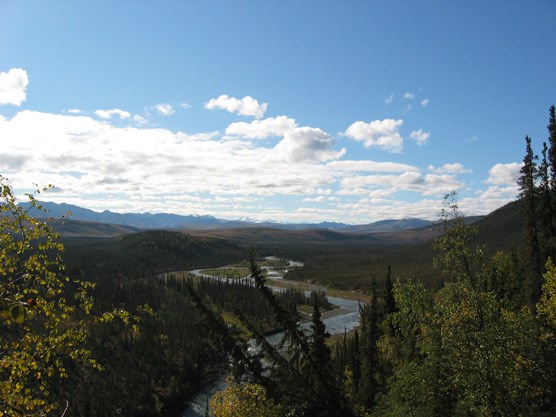
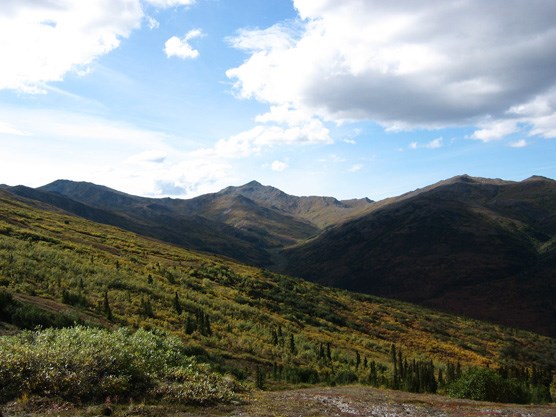
UNIT 40 Description: The Clearwater Fork of the Toklat and its many tributaries create a network of small, steep-sided valleys that drain the eastern slopes of the Kantishna Hills. The upper ends of these ridges are alpine tundra, while the lower elevations are often covered with scattered spruce stands and tall brush. The Clearwater Fork has a relatively open gravel bar throughout most of its length and is generally crossable in all but the most extreme conditions. The pass at the head of Myrtle Creek over to Moose Creek is gentle and covered with low brush and moist tundra. 
nps photo Tips/Special Features: Most of the rivers and streams within this unit are small to moderate in size so river crossing are not as significant an issue as in other units. The ridges provide excellent views of Denali, the Outer Range and the Alaska Range. Good navigational skills and familiarity with cross country hiking are recommended because of the complex drainage systems in the unit. Access: There is no Park Road access to this unit and it takes at least one night in another unit to reach this area. The primary access routes are discussed in the descriptions for other units. They involve coming in from the east via the Stony Creek drainage (Unit 39), from the south out of Moose Creek (Unit 34), from the north on the Toklat River (Unit 38), or from the west across the ridges of the Kantishna Hills (Unit 41). The Clearwater Fork is the primary lowland travel corridor within the unit and many of the other possible routes eventually connect into it. The Clearwater is not a glacial river, but it still has a moderate sized gravel bar that is open enough for reasonable hiking. Crossing it is usually possible except in extreme rain conditions. 
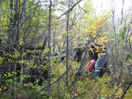
nps photo One of the other major travel routes in the unit is the crest of the Kantishna Hills along the unit’s western boundary. The Kantishna Hills are a 30-mile chain of low mountains running from Brooker Mountain (near Wonder Lake) northeast to the Toklat River. The ridgelines are covered with tundra, while the low-lying areas consist of taiga forest. The rise and fall of the ridgeline means that hiking is slow in places; but it is not technically difficult. Numerous side ridges and creeks lead down into the Clearwater Fork and can be used to connect these two natural travel routes. You can reach the Clearwater from Stony Creek to the east (Unit 39) or at its southern end from upper Moose Creek near the Mt. Galen area (Unit 34). Additional Notes and/or Hazards: Mosquitoes are usually dense in this part of the park in June and July. If you plan to hike in this unit, be aware that it is outside of designated Wilderness. In 1980, Mount McKinley National Park was expanded and renamed Denali National Park and Preserve and this area was included as part of the new Park additions. The Kantishna Hills and surrounding area is a historic mining district dating back to the early 1900s. There are, to this day, patented and un-patented mining claims in the Hills. There is also private property, including privately owned and operated lodges. People who have traditionally hunted, fished and trapped in the area continue to do so. The miners in this area established travel routes along ridges and in creek beds to access their claims. There are cabins, equipment, old roads and assorted refuse on public and private land in very remote areas. Hikers in the Kantishna Hills must respect private property and the cultural significance of the mining history. Do not disturb the historic relics and never enter a private residence. If you obtain a backcountry permit for Units 40 – 43, be sure to take a free hand-out from the BIC which explains regulations and warnings pertaining to the Kantishna Hills. It may be unsafe to drink the water from the following streams due to heavy metal contamination: Eldorado, Slate, Friday, Eureka, Caribou, Spruce, Glacier, Stampede and Moose Creek below Spruce Creek. Water filters, boiling and chemical treatments are ineffective for treating water with heavy metal contamination. 
nps photo |
Last updated: September 1, 2015
