|
UNIT 21
This large unit stretches from the McKinley River to the snout and vast moraine fields of the Peters Glacier. The major elevation gradient that occurs from the Alaska Range in the south to the outwash plains and gravel bars of the north has a strong influence on the vegetation patterns in the area. They vary from glacier covered slopes and steep scree to open alpine tundra to black spruce woodlands. In between there is a mosaic of moist tundra ridges and brushy hillsides. .jpg?maxwidth=1300&maxheight=1300&autorotate=false)
Photo courtesy Jessica Toubman Tips/Special Features This unit is known for spectacular views of the Alaska Range, pristine conditions and very little use, but access to the unit and travel within it are extremely difficult. This is the start of the western wilderness of the park and prior experience with cross-country hiking and major glacier river crossings is strongly recommended. This part of the park is best to access in late August and early September when the fall colors are peaking and the river levels are down.
There is no road access to this Unit. Access is from Unit 15, leaving the Park Road about 0.25 miles east of the Wonder Lake Campground and hiking down the McKinley Bar Trail to the McKinley River. At that point there is no established route to the south side of the McKinley River where Unit 21 starts. See Units 20, 14 and 15 for further information on crossing the McKinley River. This area is best for people who are doing hikes of 4 nights or longer and want to feel like they are in a remote part of the Alaska Range. Due to the challenges of getting into Unit 21, it is not recommended for backpacking trips of 3 nights or less. To access this area, most hikers follow the McKinley River bar downstream to the Muddy River. There is an area informally called “the narrows” about 3 miles west of the McKinley River Bar Trail that can be challenging to get around as the river flows in fewer channels and tends to bank up against the north side. The McKinley River changes its course throughout the summer so the Backcountry Information Center will not necessarily know the best way to get around the Narrows. Clearwater Creek lives up to its name, with crystal clear water, but it also can be very difficult to cross when it is a single channel. The best crossings are near the McKinley River Bar where its grade drops; the creek becomes more difficult to cross when you go more than a mile upstream. Clearwater Creek is a poor travel corridor on foot, with few braids, swift water and rapids. 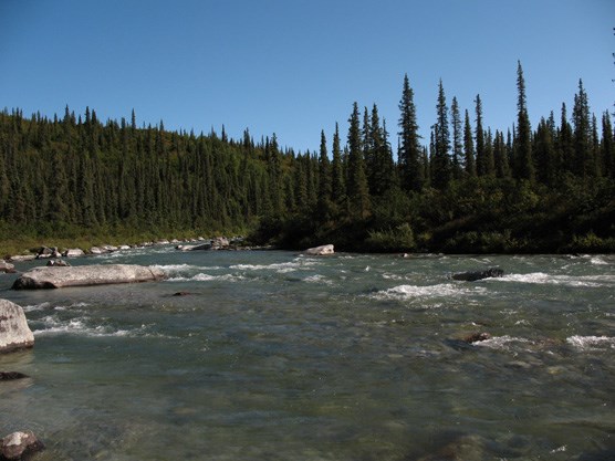
NPS Photo The Muddy River is a logical travel corridor for any hikers going north or south. It is a large glacial river with open gravel bars at its north end and easy travel up the east side once you leave the McKinley River area. Do not attempt to cross the McKinley River after the Muddy runs into it; the power of these two combined glacial rivers makes it impossible to cross by foot. At the south end of the Muddy River, the river becomes narrower and harder to cross, but travel along it is still possible. You can stay on the east side of the river all the way up to the snout of the Peters Glacier by walking on gravel bars and glacial moraine. Travel to the west or east from this corridor is generally better in the drier foothills of the southern half of the unit where there is more open tundra vegetation due to increasing elevation. For extended trips, you can continue hiking west into Unit 22 into even more remote areas. Depending on the flow of the Muddy River, it can be easier to cross the debris-covered toe of Peters Glacier than the river itself.
Always bring extra food with you when you attempt a trip on the south side of the McKinley River in case you need to wait a few days for the river to lower. Travel onto the Peters Glacier requires previous glacier crossing experience. |
Last updated: August 30, 2015