Last updated: October 8, 2021
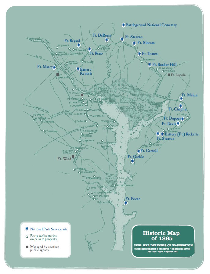
Civil War Defenses of Washington 3545 Williamsburg Lane N.W. Washington, DC 20008
202-829-2163