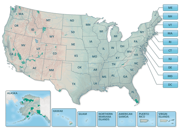
Find a National Park Service map to plan your next park visit. Search and download our catalog of +1000 maps directly to your mobile device or print and hang on your wall at home. All NPS maps produced by Harpers Ferry Center are free and available as JPEGs, PDFs, or Adobe production files.
Click on a State

Find a park map by state or territory.
Search for a park map by keyword, state, or park
Special Maps and Collections
National Park System Maps – Includes the National Park System Map & Guide, National Park Guide, four versions of the National Park System Map, and the National Park Service Regions Map.
Map Resources & Information
Data Sources & Accuracy Statement – Users of National Park Service maps are encouraged to read this information.
NPS Map Symbols – Recreation symbols, bar scales, road shields, patterns, etc.
Printing Oversized PDF Maps – Instructions on how to print oversized PDF format maps on a typical desktop printer.
Production Tips for NPS Maps – Instructions on how to use national park maps in Adobe Illustrator format, and how to use raster shaded relief files.
Starter Maps – Starter Maps provide all the ingredients needed to make a standard National Park Service map—labels, symbols, line styles, and area colors—on layers in Adobe Illustrator CS2 format.
Questions about NPS Maps?
If you have questions or comments about National Park Service maps, please contact HFC Cartography at HFC_Cartography@nps.gov.
Additional National Park Service Contacts
Obtain GIS Data
Obtain National Park Service Geographic Information Systems data and metadata for the National Parks from the NPS Geographic Information Systems website.
Last updated: December 5, 2023
