National Park Service LogoU.S. Department of the InteriorNational Park ServiceNational Park Service
National Park Service:  U.S. Department of the InteriorNational Park Service Arrowhead
Canyonlands National ParkSeedling in Biological Soil Crust
view map
text size:largestlargernormal
printer friendly
Canyonlands National Park
All-sky Images
 

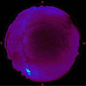
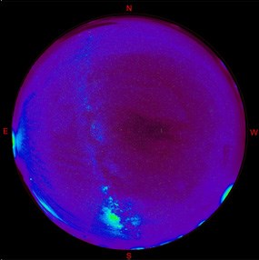
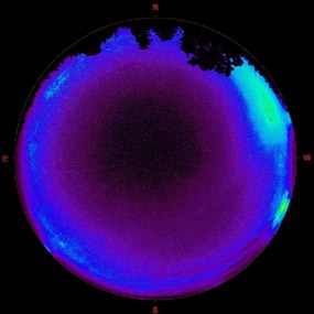
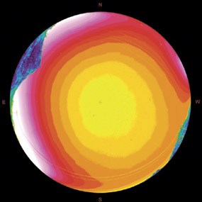
Shown below are preliminary data images from the Night Sky Team. These images show the full night sky as if you were laying on your back looking up. The colors show precise levels of brightness, with the darkest areas displayed in deep purple and the brightest areas (due to light pollution) in yellows, reds, and whites.
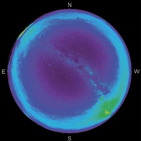
 
photo: Grand View Point, Canyonlands National Park
Grand View Point, Canyonlands National Park
 
photo: Natural Bridges National Monument (southeast Utah)
Natural Bridges National Monument (southeast Utah)
 
photo: Hovenweep National Monument (southeast Utah)
Hovenweep National Monument (southeast Utah)
 
photo: Yovimpa Point, Bryce Canyon National Park (southwest Utah)
Yovimpa Point, Bryce Canyon National Park (southwest Utah)
 
photo: Santa Monica Mountains National Recreation Area (outside Los Angeles, CA)
Santa Monica Mountains National Recreation Area (outside Los Angeles, CA)
The Night Sky Team
The Night Sky Team
Working across the country to document the effects of light pollution.
more...
Rapids in Cataract Canyon  

Did You Know?
The highest recently recorded flow in Cataract Canyon is 114,900 cfs in 1984. However, scientists dating driftwood piles estimate that in 1884, the river may have reached 225,000 cfs.
more...

Last Updated: July 10, 2006 at 15:19 EST