|
It is difficult to overstate the importance of water as a resource. Amplifying the importance of water on Cape Cod is the fact that the fresh water supply comes solely from an underground aquifer system that is recharged almost exclusively through precipitation. With this in mind, the Cape Cod National Seashore, in collaboration with the United States Geological Survey, has developed a standardized, long-term methodology of monitoring hydrological activity on the Outer Cape. The freshwater aquifer of the Outer Cape is bound laterally and below by salt water and is divided into four distinct flow "lenses." These flow lenses are detailed in the map below. Coastal hydrological processes are also of great interest, especially as they relate to salt marsh restoration projects throughout the Seashore. Climate change, sea-level rise, and increased withdrawal rates from groundwater all have the potential to significantly impact the fresh water resources critical to the human population and the sensitive coastal ecosystems of the Outer Cape. The Seashore's long-term hydrological monitoring program will provide a better understanding of the effects of both natural and human-induced change on groundwater levels of the Cape Cod aquifer. 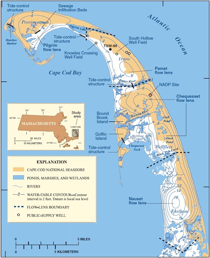
Courtesy USGS Reports and Publications: Hydrological Monitoring Resource Brief Potential Changes in Ground-Water Flow and their Effects on the Ecology and Water Resources of the Cape Cod National Seashore, Massachusetts - USGS Report by John P. Masterson and John W. Portnoy |
Last updated: April 28, 2015