|
It is impossible to understand the natural systems of Cape Cod without first considering geology. In his popular 1966 book titled A Geologist's View of Cape Cod, Arthur Strahler explains that "through its whole extent, Cape Cod consists almost entirely of sand, gravel, silt, clay, and boulders, with no solid bedrock whatsoever showing anywhere or even to be found at depths of many feet below the surface." He continues, "[one] can see here the work of the great glaciers of ice as they shaped the first outlines of the Cape and also the forms fashioned by waves, wind, and streams which have worked unceasingly since the ice sheets wasted away." 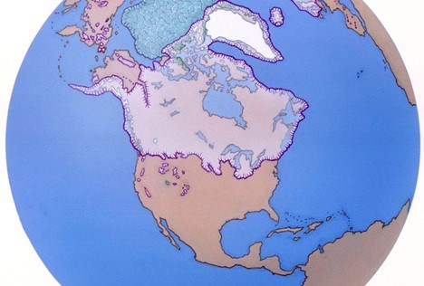
Illustration/Lloyd K. Townsend, Jr. These underlying forces of "waves, wind, and streams" are what have shaped the landscape of the Seashore since glaciers retreated north from this part of New England approximately 18,000 years ago. Cape Cod is a dynamic system and continues to change in subtle but measurable ways all the time. 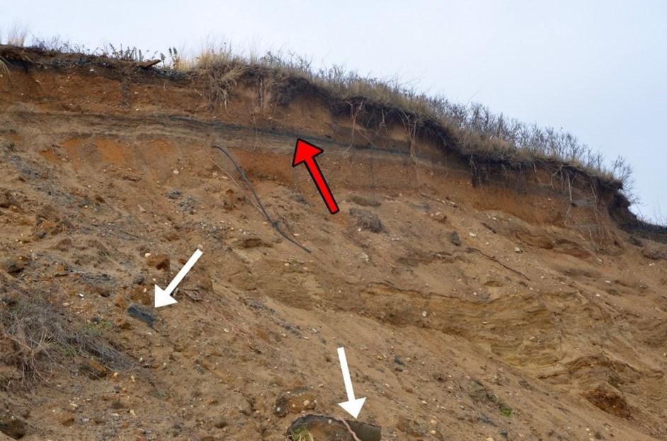
Photo/Charlotte Hohman, NPS
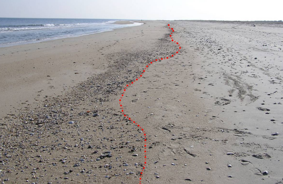
The National Seashore has long been gathering one-dimensional (1D) data, which focuses on tracking the position of the ocean shoreline. As a coastal park, shoreline erosion and human activity poses a major threat to natural resources such as habitat space, cultural resources like archaeological and historical sites, and infrastructure used by the public such as parking lots for beach access. Climate change is only expected to accelerate these rates of erosion. As a result, keeping track of our shoreline’s movement is essential, and surveys of the high tide “swash line” on our beaches are done annually. Cape Cod National Seashore scientists are currently investigating ways to better monitor our shoreline.
Photo/National Park Service Inventory and Monitoring Program
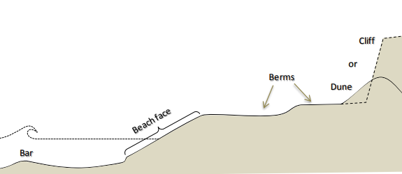
However, we need more than 1D data to make informed management decisions regarding our everchanging coastline. Coastal topography is a measure of the relief, or relative height, of the coastline, which includes the bluffs, beaches, and barrier dunes. This is considered two-dimensional (2D) data and is often referred to as ‘profiles’, because it is like looking at our beaches in cross-section Bluffs are retreating throughout the park and will eventually collapse as part of the erosion process. Cape Cod National Seashore has records of and data from beach profiles created by the US Coast and Geodetic Survey in the 1880’s. There are plans to repeat a subset of this survey, which will give park scientists an idea of how much the topography of our coasts has changed in the last century and a half.
Diagram/National Park Service Inventory and Monitoring Program
Lastly, three-dimensional (3D) data is used in areas of concern, typically in front of infrastructure or culturally significant locations. There are multiple ways to gather 3D data, but scientists at Cape Cod National Seashore have recently been using terrestrial LiDAR. LiDAR stands for “light detection and ranging” and works by bouncing laser beams off the surrounding environment and measuring how long it takes the beam to return to the device. A 3D model of the area is produced from the LiDAR data, allowing us to visualize and explore places of severe erosion in detail.
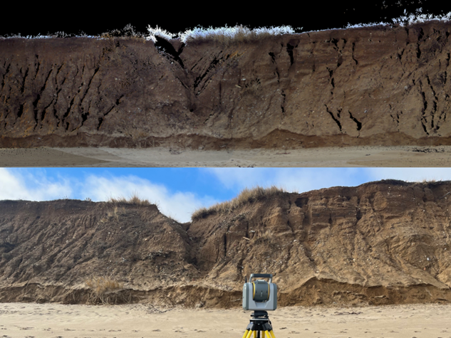
Photo/Scott Rasmussen, NPS
To help reduce impacts to the coastline, please follow all posted signs warning to stay off the dunes and bluffs. These are fragile environments, and playing on or climbing them could lead to the collapse of the feature and possible injury.

Photo/Environmental Protection Agency |
Last updated: April 18, 2024
