National Park Service LogoU.S. Department of the InteriorNational Park ServiceNational Park Service
National Park Service:  U.S. Department of the InteriorNational Park Service Arrowhead
Bryce Canyon National Park Top of Amphitheater
view map
text size: largest larger normal
printer friendly
Bryce Canyon National Park
Natural Bridge Camp Site

This site is 3.0 miles (4.8 km) south of the Swamp Canyon Campsite and 3.9 miles (6.3 km) north of Iron Spring Campsite. The closest reliable water is at Iron Spring. The Natural Bridge arch is not visible from the campsite. You can catch a long distance glimpse of part of Natural Bridge from a clearing about a half mile south of the campsite. At the campsite there are logs and rocks to sit on. You can see the cliffs between the Ponderosa, Juniper, Mountain Mahogany and Blue Spruce.

Datum WGS 84, 37 31 36.2 N, 112 14 28.4 W. Altitude 7572 feet (2308 m).

 
Natural Bridge Campsite
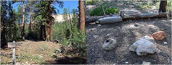
text and images courtesy of Ron Warner
Natural Bridge Campsite

You are exiting the National Park Service website

Thank you for visiting our site.

You will now be redirected to:

We hope your visit was informative and enjoyable.

Bryce Canyon Lodge

Did You Know?
The Bryce Canyon Lodge, constructed in multiple phases throughout the 1920s, is a National Landmark on the National Register of Historic Places. It is the last of the original lodges, designed by Gilbert Stanley Underwood and built by the Utah Parks Company, to survive within the Grand Circle.
more...

Last Updated: November 29, 2006 at 16:45 MST