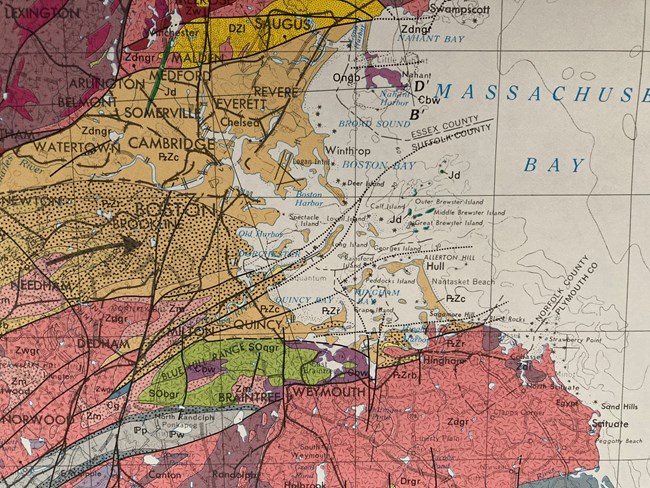
The Boston Harbor area of the USGS 'Bedrock Map of Massachusetts' Having once been set in a shallow inland sea far from its current latitude, Boston Harbor now hosts a convergence of many unique geologic features that draw the interest of geologists and anyone interested in glacial geology or coastal geologic processes. Boston Harbor sits above a suite of rocks made of sediment deposited in an ancient shallow sea environment more than 250 million years ago. These sedimentary rocks were subsequently uplifted, and some were deformed by heat and pressure, becoming metamorphic rocks. Together, these rock types form the bedrock that underlies what is called the Boston Basin, including Boston Harbor. Bedrock is clearly exposed on the surface of many of the Boston Harbor Islands. Much later, within the last 100 thousand years the surfaces of these rocks were carved by multiple periods of glaciation, and new geologic features called drumlins were deposited by glacial ice and meltwater rivers, then sculpted by retreating glacial ice. The most recent glacial retreats that carved the current island landscapes occurred between 20,000 and 10,000 years ago. Beneath the Boston area lie bedrock layers of Paleozoic sedimentary rock (mostly a formation known as the Cambridge Argillite) and some igneous formations (rocks derived directly from cooling magma), largely in the form of intrusive sills. Sills are flat or horizontal deposits of rock that form from melted rock that fills between existing rock layers and cools. Several faults run through the region—which are broad, linear planes that break up rock formations—many of unknown origins, underscoring the area’s complexity. Overall, the sedimentary rock layers of the Boston Basin are softer than the hard granite rocks found to the north and south, and are thus comparatively more easily eroded, thus leading to the harbor being carved and sculpted out over millions of years by several river valleys into its current shape. 
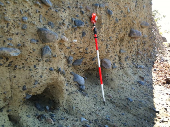
NPS Photo Many prominent glacial features can be found throughout the Boston Harbor—including the islands themselves. Throughout the park and the greater Boston area you can find drumlins, which are oblong hills made up of huge piles of clay, sand, gravel, cobble, and boulders all mixed together (which is known as glacial till) and deposited by rushing rivers on top of or inside of melting glaciers. These drumlins are sculpted by the glaciers as the glacial ice moves, leaving the drumlins shaped like upside-down teaspoons. In fact, Boston Harbor is the only partially – drowned drumlin field in North America, and one of only three in the world! Also, glacial erratics are found on the park shores, which are boulders of all sizes and rock types that are carried great distances by glaciers and dropped far from their origins. A few eskers can also be seen, which are thin, meandering lines of low hills that are formed as rivers of glacial melt water flow beneath the ice and deposit sediment. A kettle pond is a deep depression resulting from a block of glacial ice that was surrounded by sediments then subsequently melted and filled by water is thought to be the origin of the large southern salt marsh on Thompson Island, Finally, slickensides and similar features are seen on exposed bedrock, which are striations and linear scratch-marks that mark glacial flow. Boston experienced several periods of glaciation, so it is no wonder that many of the geologic features here continue to tell the story of these incredibly large areas of moving ice. To learn more about the geology of the Boston Harbor Islands and the surrounding region, check out: Boston Harbor Islands National Recreation Area: Geologic Resources Inventory Report (nps.gov) |
Last updated: January 24, 2024
