|
Over time, the park’s aquatic fauna have adapted to the flashy flow regime of the Big South Fork Cumberland River and alterations in flow (e.g., changes to the timing, magnitude, duration and/or frequency of floods) could have a negative impact on the ecological integrity of the river’s aquatic ecosystem. The park’s watershed provides habitat for a number of state and federally protected fish and mussels, including several species considered endemic to the Big South Fork Cumberland River.
To assist in monitoring these changing water levels, the United States Geological Survey maintains four river gauges in and around the Big South Fork National River and Recreation Area.
You can bring up all three river gauge readings under Scott County, TN through this website: https://waterdata.usgs.gov/tn/nwis/current/?type=flow. American Whitewater maintains a national database of river gauge readings. The following links will provide river gauge information for Kentucky Rivers and for Tennessee Rivers. 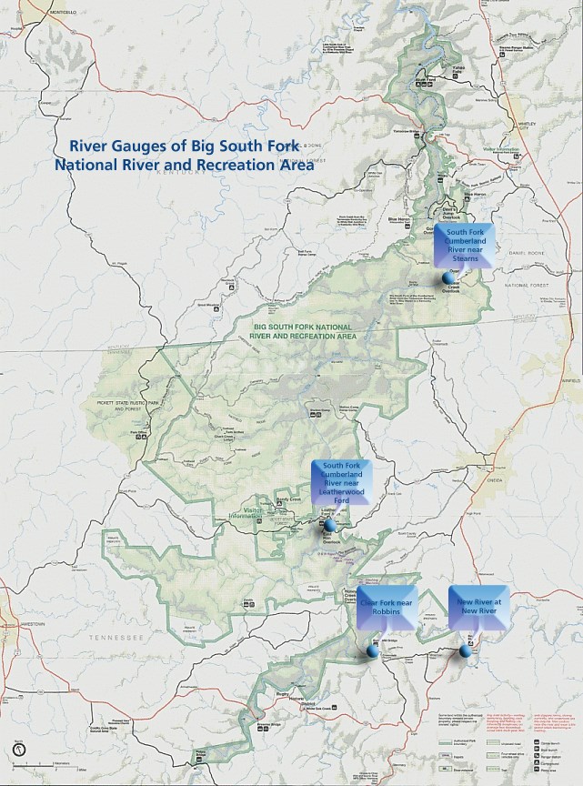
Stream Gauge Frequently Asked QuestionsWhat is gauge height? Gauge height is a measure of how high the water is above an arbitrary point, usually the stream bottom. River stage or gauge height is measured in feet. Is the volume of water in a stream with a gauge height of 20 simply twice the amount of water in the same stream with a gauge height of 10? No, due to irregular stream banks, the difference in volume can be more than double. The relationship between gauge height and stream discharge (see below) is not linear. What is Stream Discharge? Stream Discharge is a measure of the amount of water being carried by a stream at a certain place per unit time. Discharge is measured in cubic feet per second and the reading displayed above is specific to the Leatherwood Ford Gauge. Average velocity and cross sectional area are used to calculate stream discharge. These values are derived by measuring stream depth and average velocity at intervals across the stream from water’s edge to water’s edge at a particular point. Values are recorded along a transect or tag line deployed at right angles to the direction of flow. Discharge may be calculated manually or through the use of automated equipment such as stream gages. The Leatherwood Ford Gauge readings are recalculated every 15 minutes. What are routine flows during summer/winter? Streamflow of individual streams of the Cumberland Plateau varies widely in response to seasonal variation in precipitation. Seasonal baseflow the Big South Fork at Leatherwood Ford ranges from 3,000-5,000 cubic feet per second (cfs) during the wettest months (March through May) to less than 50 cfs during August through October, the driest months of the year in Tennessee. Rapid, dramatic increase in streamflow on Cumberland Plateau streams frequently occurs in response to heavy precipitation events at any time of the year. The Plateau is characterized by thin soils overlying relatively low permeability sandstones and shales; consequently, there is limited capacity for storage of rainfall within the soils and bedrock, and overland runoff is promoted as these thin soil layers become saturated quickly during storm events. In response, stream flows can rise very quickly. During a two day precipitation event during April 21-23, 2017, streamflow of the Big South Fork increased from 1,400 cfs to over 58,000 cfs, representing a stage increase from 7.3 feet (3 feet below the low water bridge decking) to 31.7 feet (nearly 22 feet above the low water bridge decking.) The April, 2017 storm occurred during the wet season, but dramatic increase in streamflow could occur at any time of the year. Water can rise rapidly with little warning, so be cautious when camping near larger streams and, if boating, know the reach you plan to paddle and what flow level is normal for that reach and season. |
Last updated: September 9, 2022