|
Established as one of America's first national preserves, Big Cypress protects over 729,000 acres of a vast freshwater swamp ecosystem, which supports the rich marine estuaries along Florida's southwest coast. The hydrology of Big Cypress is predominantly rain driven, though the very east side of the preserve may also receive some water from Lake Okeechobee. While canals and rivers draw most of the attention when people think of water flow, a majority of the water in Big Cypress moves across the landscape in what is called “sheet flow.” Sheet flow can be described as shallow water, miles in size, slowly moving across the landscape towards the ocean. Big Cypress typically begins its wet season in the late spring, with peak water levels by early autumn. This, in turn, is followed by a dry season as water declines, usually reaching their lowest levels by the spring. This cycle, while a good general rule, is not absolute - like anywhere else, the Preserve is subject to periods of contradictory weather, resulting in the occasional dry summer and wet winter. 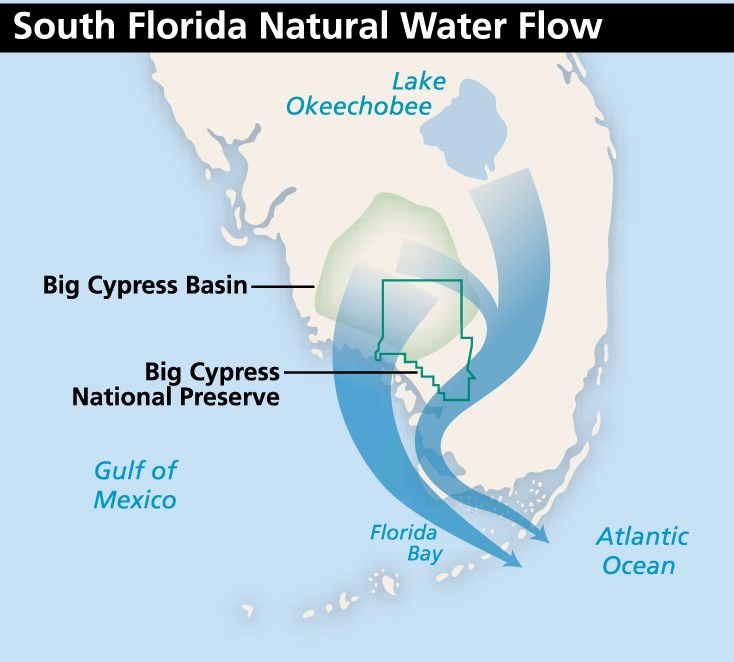
|
Last updated: January 26, 2024