Gillette and Sharpe 1891 Canyon Trek

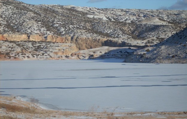
Near Crooked Creek during winter
Gillette and Sharpe passed through the Bighorn Canyon area while the water was still frozen.

Friends of Bighorn Lake


“Hanging on with fingers and toes”
On March 7, 1891 two men set out on a trek through Bighorn Canyon. Despite the fact that the area was still in the throes of winter and the river was frozen over, E. Gillette and N.S. Sharpe, a prospector, entered the canyon at Horseshoe Bend. Along with them, they pulled a sled loaded with camping supplies and rations which were to last five days. From this trip, Gillette published one of the first detailed descriptions of what could be seen deep inside the canyon.

Not long after setting out the men were dwarfed by the canyon at a “height of 500 feet, with vertical walls.” Near the Montana/Wyoming state line they encountered a Chicago, Burlington and Quincy Railroad crew running a survey to ascertain the possibility of a rail line through the canyon. Gillette marveled at the sight of surveyors working their way around “almost vertical cliffs, hanging on with fingers and toes.” This was in an area where the rocky slopes were up to 45 degrees in grade.

Gold in paying quantities
Gillette was one of the first to view the magnificent Devil Canyon, with rock walls 1,000 feet in height. Numerous tracks of wolves and mountain sheep could be seen in the snow. Camp for that night was made at the Sentinal, a pillar of limestone rising a hundred feet in height by twenty feet in diameter. Four miles downriver from the Sentinal, the men found gold colors in the Bobcat, Twentymile and Gyp creeks as they discharged into the Bighorn. This would not be the last time that prospectors were lured by the promise of riches in the Canyon.

On the 9th, two days into the trip, Gillette sighted a “knife-edge” formation at the mouth of Deadman Creek. This “pinnacle on the point towering 700 feet above the river” was named the Tower. A day later, Sharpe found paying quantities of gold at the mouth of Templeton Creek. That night the men camped on a shelf of rock. As they stared upward they noticed a strange phenomenon, the wind was whipping snow wildly on the rim of the canyon, while their camp was dead calm.

Homborg Whirlpool
They awoke early on March 11th, loaded their sled and headed further down the canyon. Passing Big Bull Elk Creek, a level piece of land estimated at 80 acres in size was discovered. This was the first piece of flat ground since Horseshoe Bend. Once again, the canyon widened and reached 1,000 feet, heights not seen since Devil Canyon. After passing Black Canyon, the steepest rapids on the Bighorn, the notorious Homborg Whirpool, came into view. The water “was confined to a narrow bed less than 40 feet wide, the usual width being from 200 to 300 feet.”

From here to the mouth of the canyon, there were many rapids. Warm springs had melted the ice, forcing Gillette and Sharpe to make the rest of the trip along the river bank. Following one last night in the canyon the men reached the valley of the Bighorn. They camped just opposite the ruins of Fort C.F. Smith. They then turned around and made the return trip via Bad Pass Trail, following rock cairns that were left to mark the path over the previous centuries.

(Sources: Bighorn Canyon Historic Resource Study, Edwin Bearss; “The First Trip Through Big Horn Canyon” Magazine of the American Society of Civil Engineers, E. Gillette.)

Last updated: February 24, 2015

Park footer

Contact Info

Mailing Address:

Bighorn Canyon National Recreation Area South District Visitor Center
20 US Hwy 14A

Lovell, WY 82431

Phone:

307 548-5406
(307) 548-5406 is the South District in Lovell, WY. (406) 666-9961 is the North District in Fort Smith, MT.

Contact Us