In the arid Southwest, water means life, and prehistorically, rivers were the lifelines of the people.
The distributions of many prehistoric Southwest cultures conform to the outlines of drainage basins, no doubt because drainages were major orienting features of daily life, providing places to drink, farm, hunt, gathers, an reflect or practice rituals. Rivers also surely proved major landmarks and served as transportation corridors in the prehistoric Southwest.
Major rivers of the Southwest include:
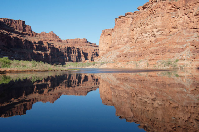
The Colorado River
Neal Herbert / NPS
The Colorado River is considered the primary river of the Colorado Plateau in the American Southwest. The headwaters of the Colorado are located in Rocky Mountain National Park (Colorado) at proximally 9,000 ft (2,740 meters) above sea level. From the headwaters, the Colorado flows west through Colorado, Utah, and Arizona, and then south along the borders of Nevada, Arizona, and California. On its way to the Gulf of California in Mexico, the Colorado River passes through the Colorado Plateau, where it is best known for its role in the formation of the Grand Canyon, and the Southern Basin and Range, which includes both the Sonoran and Mohave deserts.
The Colorado River and its many tributaries were vitally important to prehistoric people, serving as home to ancient people as early as 10,000 years ago. Today, the river remains home to many Native American tribes, including the Colorado River Indian Tribes, the Navajo Nation, the Hualapai Tribal Nation, and the Havasupai Tribe.
Length: 1,450 miles (2,330 km)
Tributaries: Virgin River, Kanab River, Escalante River, Dirty Devil River, Green River, Little Colorado River, San Juan River, Dolores River, Gunnison River (Upper and Middle Colorado River); Gila River and Bill Williams River (Lower Colorado River).
Prehistoric Cultures: Ancestral Puebloan, Patayan (Hakataya)
Native American Cultures: Paiute, Ute, Navajo, Hopi, Mohave (Mojave), Chemehuevi, Quechan (Yuma), Halchidhoma, Cocopah, Maricopa, Havasupai, Yavapai, Hualapai, and Pee Posh (Maricopa).
National Parks and Monuments: Grand Canyon, Glen Canyon National Recreation Area, and Rainbow Bridge.
External Links
The Gila River
Deidra St. Louis / U.S. Forest Service
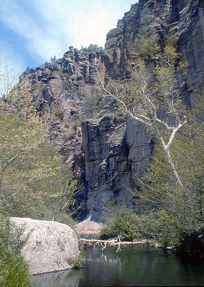
The Gila River extends westward from southwestern New Mexico to its confluence with the Colorado River near Yuma, Arizona. Although free-flowing in western New Mexico and eastern Arizona, the Gila rarely contains water once it reaches central Arizona. However, prehistorically, the Gila River in central Arizona was home to the Hohokam, and may even be the region in which the culture developed. Like all rivers in the Southern Basin and Range, in Arizona, the Gila River provided prehistoric people the water necessary for life, and particularly for farming. Today, the Gila River Indian Community, the Ak Chin Indian Community, and the San Carlos Apache remain on the river.
Length: 650 miles (1,050 km)
Tributaries: Salt River, Agua Fria River, San Pedro River, and San Francisco River.
Prehistoric Cultures: Patayan (Hakataya), Hohokam, Salado, Mimbres Mogollon
Native American Cultures: Akimel O’odham (Pima), Pee Posh (Maricopa), Apache
National Parks and Monuments: Gila Cliff Dwellings, Casa Grande, and Hohokam Pima
External Links
The Salt River
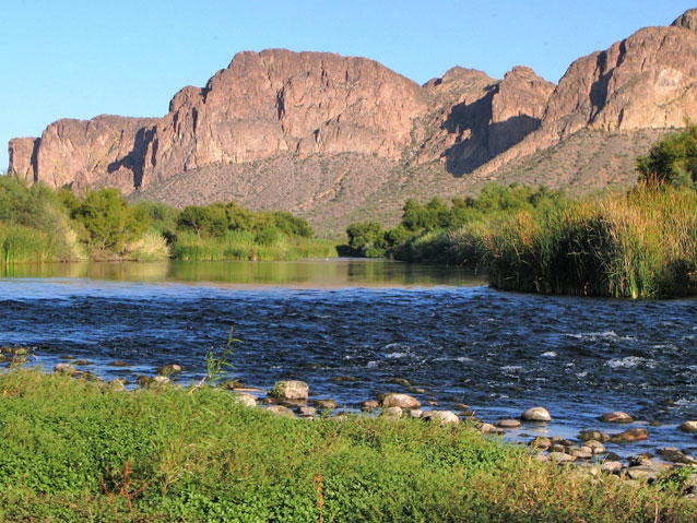
The Salt River begins in the valley between the Mogollon Rim and the Natanes Plateau in eastern Arizona and then flows through the Salt River Canyon and Tonto National Forest, before joining the Gila River in the Phoenix Valley. Prehistorically, the Salt River was home to the Hohokam, who constructed elaborate canal networks that allowed them life in the desert. Today, the Salt River remains home to the Salt River Pima-Maricopa Community, the Fort McDowell Yavapai Nation, the San Carlos Apache, and the White Mountain Apache Tribe. In the Salt River Valley, the ancient canals of the Hohokam, now modernized, continue to provide much needed water to the residents of Phoenix and surrounding cities.
Length: 200 miles (320 km)
Tributaries: Verde River
Prehistoric Cultures: Hohokam, Salado
Native American Cultures: Akimel O’odham (Pima), Pee Posh (Maricopa), and Apache
National Parks and Monuments: Tonto
External Links
The Verde River
USFS
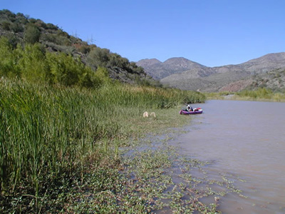
The Verde River originates at Sullivan Lake in northwestern Arizona and flows south through Tonto National Forest to its confluence with the Salt River just east of the Phoenix Basin in Arizona. Prehistorically, the Verde Valley was home to the Ancestral Puebloans, the Southern Sinagua, and the Hohokam. Today, the Fort McDowell Yavapai Nation continues to live near the confluence of the Salt and Verde Rivers. To the north, in the Verde Valley, the Yavapai-Apache Nation also continues to use the river resources.
Length: 125 miles (200 km)
Tributaries: n/a
Prehistoric Cultures: Ancestral Puebloan, Southern Sinagua, Hohokam
Native American Cultures: Yavapai, Tonto Apache
National Parks and Monuments: Tuzigoot and Montezuma Castle
External Links
The Santa Cruz River
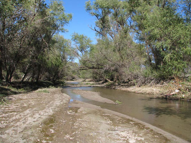
The Santa Cruz River originates just north of the United States – Mexico border, flowing south into Mexico, and hooking back into the U.S. near Nogales. From Nogales, the Santa Cruz flows north through Tuscon, Arizona, ending on the Santa Cruz Flats south of the Gila River. As one of the primary candidates for the earliest adoption of maize agriculture in the Southwest, the Santa Cruz River is of significant interest to archeologists. Historically, the Santa Cruz served as a corridor for Spanish, and later, Mexican exploration and settlement in Arizona. Today, the river remains important to the Tohono O’odham people.
Length: Not reported.
Tributaries: n/a
Prehistoric Cultures: Hohokam, Trincheras
Native American Cultures: Tohono O’odham (Papago), Akimel O’odham, Sobaipuri, Apache, and Yaqui.
National Parks and Monuments: Tumacácori National Historical Park, Saguaro, and Ironwood Forest
External Links
The San Pedro River
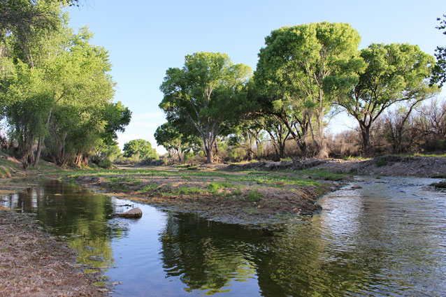
BLM
The San Pedro River originates in Sonora, Mexico and flows north to its confluence with the Gila River in Arizona. Prehistorically and historically, the river valley served as an important migration and exploration route. The San Pedro River is best known to archeologists for the presence of Clovis-era sites, including Lehner, Naco, and the now famous Murray Springs site.
Length: Approximately 140 miles (225 km)
Tributaries: Aravaipa Creek
Prehistoric Cultures: Hohokam, Ancestral Puebloan, Mogollon, Salado, Trincheras
Native American Cultures: O’odham, Sopaipuri, Apache, Zuni, and Hopi.
National Parks and Monuments: Coronado National Memorial
The Little Colorado River
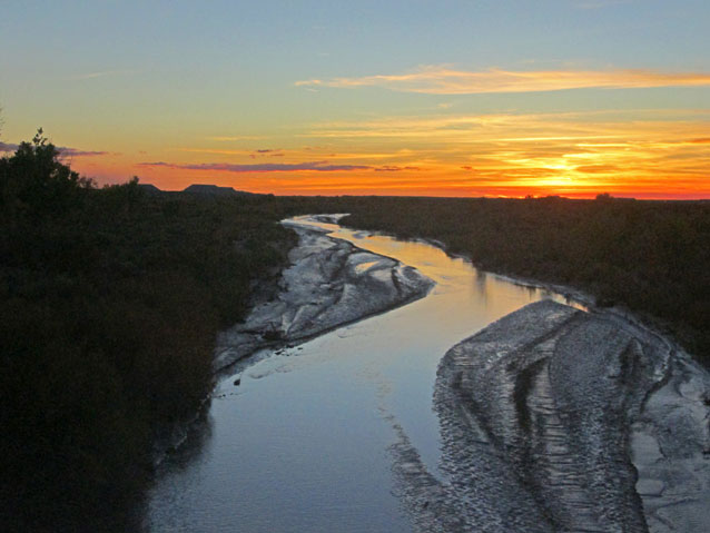
NPS
The Little Colorado River begins in the White Mountains of Arizona and meanders west to its confluence with the Colorado River in the Grand Canyon. Prehistoric use of the Little Colorado River dates back to the early Holocene, approximately 8,000 years ago. The Little Colorado River may be one of the earliest locations in which maize (corn) agriculture was adopted in the Southwest. Today, the Little Colorado River continues as a vital resource for the Navajo Nation and White Mountain Apache Tribe.
Length: 315 miles (500 km)
Tributaries: Rio Puerco
Prehistoric Cultures: Ancestral Puebloan
Native American Cultures: Navajo, Apache, Hopi
National Parks and Monuments: Grand Canyon and Petrified Forest
External Links
The San Juan River
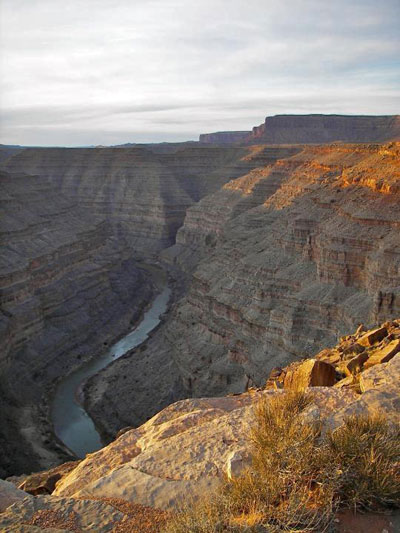
The San Juan River originates in the San Juan Mountains in southern Colorado, flowing into New Mexico, then Utah, and ultimately into the Colorado River in what is now Lake Powell in Glen Canyon National Recreation Area. The San Juan River is primarily known archaeologically for its importance in early agriculture in the Southwest and for its role in the Chacoan Regional System. Today, the San Juan River and its tributaries remain critical resources for the Navajo Nation, the Southern Ute Indian Tribe, the Ute Mountain Ute Tribe and the Jicarilla Apache Nation.
Length: 400 miles (640 km)
Tributaries: Animas River, La Plata River, Los Pinos River, Navajo River, Piedra River, Mancos River, and Chinle Creek.
Prehistoric Cultures: Ancestral Puebloan
Native American Cultures: Navajo, Ute, Jicarilla Apache
National Parks and Monuments: Glen Canyon National Recreation Area, Aztec Ruins, and Mesa Verde
External Links
The Rio Grande
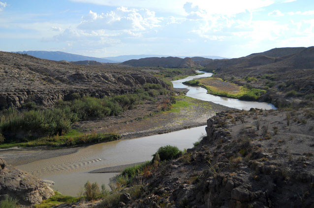
Ann Wildermuth / NPS
The Rio Grande (also called the Rio Bravo del Norte, or Rio Bravo) traverses the American Southwest from the Rio Grande National Forest (Colorado) to the Gulf of Mexico, passing through southern Colorado and central New Mexico, and then forming the border between Texas and Mexico. The occupational history along the Rio Grande and its tributaries extends back to the earliest Americans and continues to the present day. In archeology and ethnography, the Rio Grande is perhaps best known for the many pueblos clustered along its banks and tributaries. Today, 18 pueblos remain active along the Rio Grande, including Taos, Picuris, San Juan, Nambe, San Ildefonso, Pajoaque, Tesuque, Cochiti, Santo Domingo, Jemez, Zia, Santa Ana, San Felipe, Sandia, Isleta, Laguna, and Acoma.
Length: 1,885 miles (3,030 km)
Tributaries: Pecos River, Chama River, and Devils River (United States); Rio Conchos, Rio Salado, and Rio San Juan (Mexico).
Prehistoric Cultures: Ancestral Puebloans, Mimbres Mogollon,
Native American Cultures: Puebloan, Apache, Navajo, Jano and Jacome, Manso, Suma, Chisos.
National Parks and Monuments: Big Bend, Rio Grande, and Amistad
The Pecos River
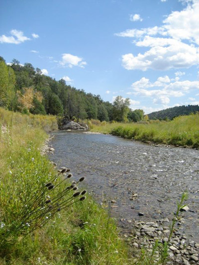
NPS
The Pecos River originates near Pecos, New Mexico, flowing through the eastern portion of the State and into Texas where it joins the Rio Grande on the border of Texas and Mexico. The Lower Pecos in particular is well known for the preservation of Archaic period perishables such as those discovered in Hinds Cave , Texas. On the Upper Pecos, early excavations at Pecos Pueblo resulted in the establishment of methods still used by archeologists in the Southwest. However, the Pecos River region is perhaps best known as one of the primary routes used by Spanish explorers entering the Southwest, and for the role of Pecos Pueblo in the Pueblo Revolt of 1680.
Length: 930 miles (1,490 km)
Tributaries: n/a
Prehistoric Cultures: Ancestral Puebloans, Mogollon
Native American Cultures: Pecos Indian Tribe, Apache, Kiowa, Comanche, and Jumano
National Parks and Monuments: Pecos National Historical Park, Carlsbad Caverns, and Guadalupe Mountains National Park
External Links
- Hinds Cave: A Perishable Scientific Treasure
- Turpin, Solveig A. 1994 Lower Pecos Prehistory: The View from the Caves. In The Caves and Karst of Texas, edited by W.R. Elliott and G. Veni, pp 69-84; National Speleological Society, Huntsville, Alabama.
Part of a series of articles titled Defining the Southwest.
Previous: Southwestern Plains
Next: Glossary
Tags
- amistad national recreation area
- aztec ruins national monument
- big bend national park
- carlsbad caverns national park
- casa grande ruins national monument
- coronado national memorial
- gila cliff dwellings national monument
- glen canyon national recreation area
- grand canyon national park
- guadalupe mountains national park
- mesa verde national park
- montezuma castle national monument
- pecos national historical park
- petrified forest national park
- rainbow bridge national monument
- rio grande wild & scenic river
- saguaro national park
- tonto national monument
- tumacácori national historical park
- tuzigoot national monument
- swscience
- american southwest
- southwest definitions
- rivers
- riparian habitat
- colorado river
- gila river
- verde river
- santa cruz river
- san juan river
- pecos river
- salt river
- rio grande
- san pedro river
- salado
- ancestral puebloan
- little colorado river
- patayan
- hohokam
- mogollon
- sinagua
- trincheras
Last updated: October 8, 2015
