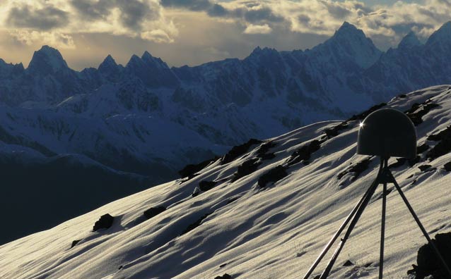
The Plate Boundary Observatory (PBO) has installed more than 1,100 Global Positioning System stations in North America, including two in Denali—near Tokosha (above) and on Wickersham Dome.
Shaking from the 2002 Denali Earthquake caused waves in lakes as far away as Texas.
NPS Photo
Alaska is well known for its rugged terrain and numerous natural hazards. It is arguably one of the most active and interesting places for geologists and geophysicists to study the Earth’s dynamics, including the processes that control plate tectonics.
The Plate Boundary Observatory
To ask and answer some fundamental questions about tectonic processes, the Plate Boundary Observatory (PBO) was set up in 2004 as an integrated network of Earth-measuring instruments. Most of these research instruments perch near active volcanoes and along faults in order to log the effects of the subduction zone at the boundary of the Pacific and North American tectonic plates. This zone has produced some of the largest earthquakes and most dramatic volcanic eruptions in recent history.
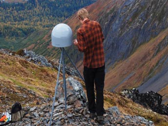
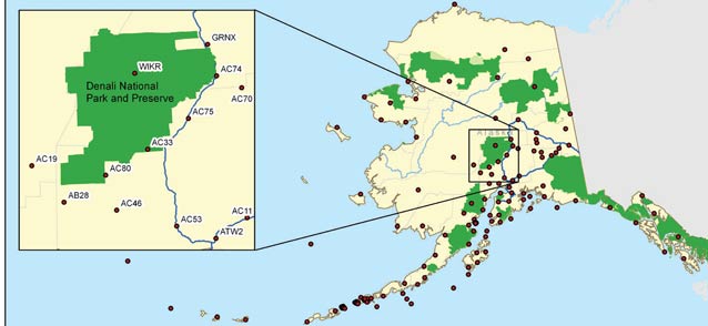
Run by UNAVCO based in Boulder, Colorado, the PBO is part of the National Science Foundation-funded EarthScope, which has been named the world’s most epic science project by Popular Science. Because of the PBO focus on plate tectonics, its engineers use geodesy (measurement of the earth in 3-D) to study the strain at the boundary of the Pacific and North American tectonic plates. Among the instruments the PBO has installed are 1,100 Global Positioning System (GPS) stations, mostly along the western coast of North America. In Alaska, there are 140 of these stations, with two of them located in Denali National Park and Preserve.
A Network of GPS Stations
Prior to the creation of the PBO, a very sparse geodetic network existed in the western continental U.S. and Alaska for monitoring potentially dangerous strain accumulation along faults. Because the Denali fault sweeps in an arc through the park, some areas of Denali are particularly high-risk for seismicity. With the additional geographic coverage of GPS stations provided by PBO, data are being collected that can be used to improve hazard analysis for public safety.
The PBO network installed stations throughout Alaska from the North Slope to the far western Aleutians. The majority of stations are located far from roads, high on ridge tops, or on the flanks of active volcanoes. Travelling overland by vehicle or on foot to most of these locations was impractical. Although physical access to station locations was a major issue, it was just one of many challenges engineers overcame to reach project success. Construction of the entire PBO network took five years and was completed in 2008.
Two GPS Stations in Denali
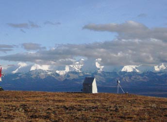
After appropriate environmental analysis and review by the park, two stations were sited in Denali using helicopter access. Both stations are co-located with other installations to minimize impacts to wilderness. The two stations located in Denali are known by the PBO as Station AC33 (near the Tokosha Communications site in the southwestern part of the park) and Station WIKR (Wickersham Dome) in the Kantishna area. AC33 was installed in 2007 and WIKR in 2008.
Denali’s two stations are located on the western end of the Denali fault zone and are used to detect and measure slip rates there. The stations also detect and measure the post-seismic deformation associated with the 2002 Denali Earthquake (magnitude 7.9). The 2002 earthquake occurred on a previously unmapped fault and continued along the Denali fault. Surface offsets of up to 29 feet (10 meters) were observed. Projects such as the PBO are important because they provide more precise maps of unnamed faults and information about the hazards associated with them.
Results: Example From the WIKR GPS Station
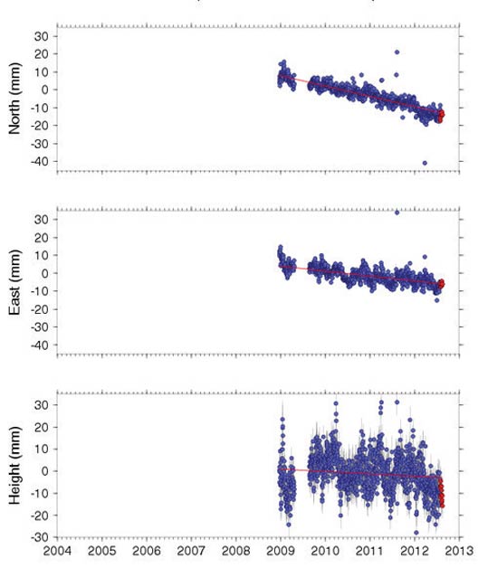
The graphs above show the value of having a long-term GPS station at a site. Even if the station moves only a fraction of an inch (or of a centimeter) per year, as the small movements in these three dimensions accumulate over years, the trending or long-term movements of the Earth—from faults or plate tectonic activity—can be detected.
The top graph shows that the WIKR station has moved to the south (north dimension has decreased) about 0.6 inch (15 mm) since 2009. The second graph shows a descending trend line, indicating that the east component is less, or that the station is moving slightly westward. The station also is showing a very slight downward motion (third graph is decreasing in the height component).
Where the time series graphs show breaks in data, or show lots of seasonal variation in motion, snow and ice loading may have influenced the readings.
When years of this kind of data have been collected and analyzed, scientists can model where tectonic forces are building up (places with earthquake potential) and infer other information about plate motion and local crustal dynamics.
Partnerships and progress
Through many partnerships—including with the U.S. Geological Survey, University of Alaska Fairbanks, Alaska Earthquake Information Center, and West Coast Tsunami Warning Center—UNAVCO.
The goal is to improve knowledge of earthquake processes and volcano behavior, in order to better assess natural hazard risk near the boundary of these two tectonic plates.
Last updated: April 21, 2016
