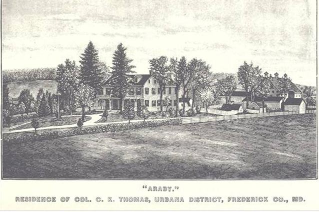
The Thomas Farm landscape was the setting for what has come to be known as "The Battle that Saved Washington." Here, where some of the heaviest fighting of the Civil War Battle of Monocacy occurred, the agricultural field patterns, 18th-century structures, and traces of transportation patterns continue to reflect the property's historic appearance and use.

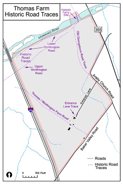
Thomas Farm, also known as “Araby,” is a landscape within Monocacy National Battlefield. It is located about three miles south of Frederick, Maryland on the east side of the Monocacy River. The property consists of nearly all of the land associated with the Thomas Farm as it existed at the time of the Battle of Monocacy on July 9, 1864. Today, Thomas Farm is bounded on the north side by the Monocacy River, on the south by Baker Valley Rd., on the west by US Interstate 270, and on the east by Araby Church Rd.

NPS
The Thomas Farm landscape contributes to the designation of Monocacy National Battlefield as a National Historic Landmark. Monocacy Battlefield is historically significant in areas of architecture, industry, social history, military history, agriculture, and commemoration. The battlefield's period of historic significance is identified as 1724 to 1964.
Within this broader landscape, the Thomas Farm landscape has a period of significance of 1724 to 1915. This represents the original patent and settlement of the property, extends through important events of the Civil War era, and ends with the construction of the Vermont Monument.
In addition to its agricultural history and the Civil War battle, the farm is significant for its commemorative value. This is represented by the construction of the 1915 Vermont Monument as part of a larger 20th century movement to memorialize the events of the Civil War.
The Thomas Farm, along with the rest of Monocacy National Battlefield, is also notable as the site of a transportation network. It began with the early colonial road and ferry that connected Frederick County to Georgetown. The position of this area as a crossroads led to its strategic importance during the Civil War and eventually to the battle in July of 1864.
The agricultural landscape of Monocacy National Battlefield served as the setting for what has been termed “The Battle that Saved Washington.” The 240-acre Thomas Farm stood at the center of the battlefield landscape, which stretched over 1,000 acres in its entirety. Some of the heaviest fighting of the Civil War battle erupted at this central location, battering the area in and around the Thomas house and shaking the fields that bordered the Worthington Farm.

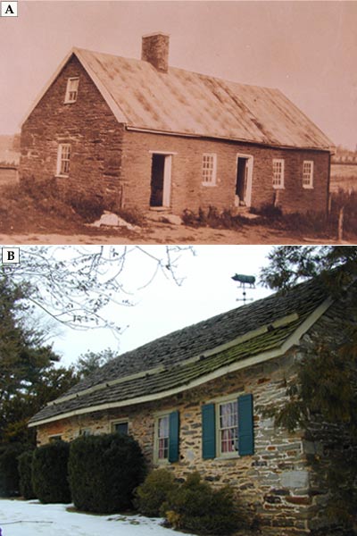
Top: Fred Cross (1931) Below: NPS (1999)
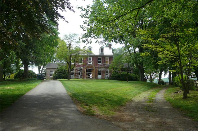
Today, the many features of the property have remained relatively unchanged since the period of significance. At least two 18th-century structures remain, including the main house and the stone tenant house. Most of the agricultural field patterns are the same as those that existed during the Civil War period and are currently maintained through an agricultural special use permit program run by the NPS.
The farm buildings and circulation patterns also continue to reflect historic arrangement and use of the landscape. The Vermont Monument, added in 1915, remains in its original position. On June 21, 1934 Congress approved an act to establish a national battlefield at Monocacy, but there was no method in place to allow for the acquisition or maintenance of property. Most of Monocacy remained in private hands and continued to be actively farmed.
Eventually, the 1,500 acre battlefield was listed in the National Register of Historic Places in 1973. The National Register documentation was initially completed in 1975, with updates in 2000 and 2008. The battlefield became a designated NPS unit in 1976.
The Thomas Farm cultural landscape retains a high degree of integrity to this period. While there have been some changes to the property and the loss of a few features, it still invokes the historic character of the landscape.

NPS (2009)
text
Quick Facts
- Cultural Landscape Type:Historic Site / Vernacular
- National Register Significance Level: National
- National Register Significance Criteria: A, C, D
- National Historic Landmark
- Period of Significance: 1724-1915
Landscape Links
Last updated: October 8, 2021
