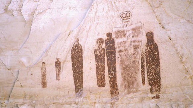
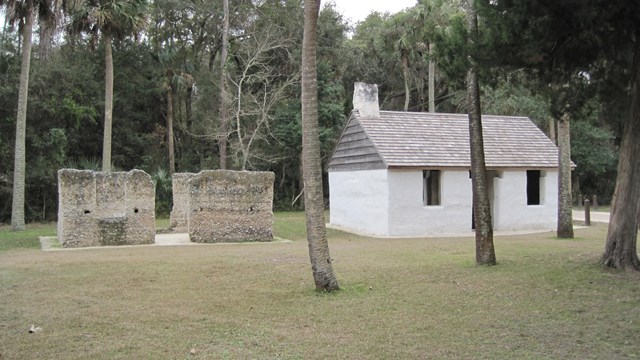
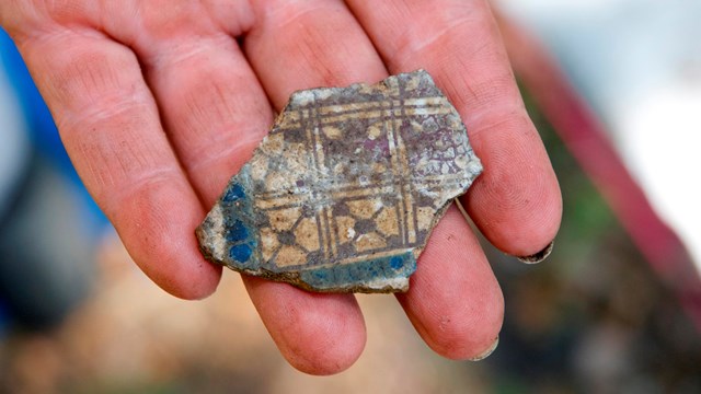
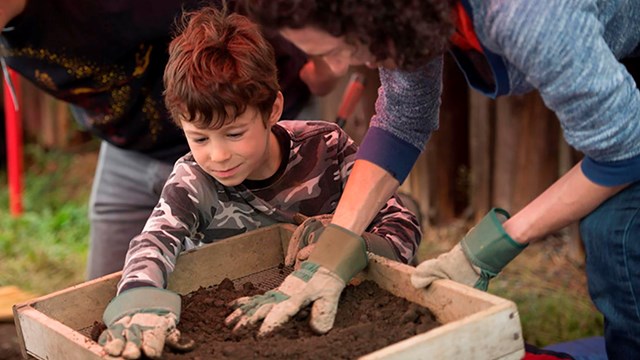
|
|||||||||||
|
Geophysical prospecting
Archeologists may use non-invasive techniques to initially characterize a site or part of a site. Geophysical prospecting is the use of high-resolution geophysical methods to discover archeological sites. These methods may also be called "remote sensing" or "archeogeophysics". Advantages to geophysical methods are that they are nondestructive and provide rapid reconnaissance. Their major limitation is that they use non-contact techniques. The best they can do is detect anomalies, which archeologists must then investigate directly to interpret. These methods are also instrument-intensive and initially expensive (see Bevan 1998.) Remote sensing
identifies archeological features buried below ground that still leave
their mark on the landscape. Shallow ground occurs over buried features
such as buildings, walls, and streets; deeper ground is found within
pits and ditches. These variations in depth affect the growth of plants
and soil color-producing patterns that are usually only visible from
above (McIntosh 1999:44). Common remote scanning methods include:
Aerial photography is the simplest of all the remote sensing techniques. It only requires a camera and a way to get it airborne, above the potential archeological site. Variations within the site that would have been totally unnoticed from the ground become obvious from a higher vantagepoint. Hot air balloons, airplanes, helicopters, and tethered blimps are all ways of getting these kinds of pictures. - Aerial infrared photography uses film sensitive to light with wavelengths slightly longer than are visible to the naked eye. When processed, the film shows normally red objects as green and green objects appear blue. Objects that give off heat, including vegetation, appear red. Buried archaeological features cause slight changes in ground vegetation by hindering growth and by blocking ground water or the natural soil movement. Infrared film's ability to detect the vegetation's heat signature makes it possible to see this effect from above. - Imaging radar
allows scientists to aerially map areas that were difficult to map
previously, due to heavy forests or dense cloud coverage. Imaging
radar uses multispectral radar frequencies sent from a space shuttle
or satellites, illuminating the Earth with microwaves that allow detailed
observations at any time, regardless of weather or sunlight conditions.
Imaging radar can also penetrate thin layers of sand, allowing archeologists
to locate sites.
Electrical
resistivity is the most flexible and most generally useful
technique for a wide variety of sites and is the best method to control
or adjust the depth of investigation. Electrical resistivity methods
are noninvasive. A resistivity meter measures the difficulty of pushing
electricity through the soil-more resistance requires more voltage.
The soil's actual ability to conduct the current comes from the amount
of moisture it holds. Compacted areas, such as floors and trails,
restrict the amount of moisture that the soil can hold, and will show
up as being highly resistive during this test. Places where the soil
has been disturbed, such as filled holes, trenches, and ditches, will
collect more moisture than surrounding soil and will show up on the
test as having low resistivity.
Electromagnetic (EM) surveys detect metals (ferrous and nonferrous) and changes in soil conductivity that may be related to moisture or chemical content. Current is induced into the ground and electrical conductivity is measured. Conductivity is the opposite of resistivity. The advantage over resistivity is that resistivity meters must make contact with the ground, while EM meters do not need to. Conductivity is most easily read in saturated soils. - Metal detectors
operate using conductivity. Although often used in illegal and unethical
artifact prospecting, metal detectors do have legitimate archeological
uses. Metal detectors are electromagnetic devices that work at low
frequencies. They are effective to the depth that is approximately
the width of the search coil. Depth also depends on the size and orientation
of the buried object and the amount of corrosion.
Ground Penetrating Radar (GPR) is commonly used in archeology to make accurate site maps and get an overall picture of the subsurface. GPR uses low-power radio waves to detect changes in density in the subsurface layers and locate buried objects. It is best to combine GPR with other methods such as EM, resistivity, and magnetometry to ensure wide coverage. GPR, like most remote sensing, is not very effective in urban settings because of interference from buildings, power lines, cars, and other objects.
Magnetic prospecting is useful and fairly inexpensive. Objects buried underground or in different ground layer densities will create small disturbances in the earth's natural magnetic field where they focus the magnetic flow into a stronger field. If an object is more permeable than the soil (which has magnetic properties), then the magnetic field will be stronger through that object. A magnetometer, also referred to as a gradiometer or proton magnetometer, measures how these variations in the Earth's magnetic field affect the protons of the subsurface objects.
|
||||||||||||||||||
MJB/MDC